Ts'oogot Gaay Lake facts for kids
Quick facts for kids Ts'oogot Gaay Lake |
|
|---|---|
| Location | Yukon |
| Coordinates | 62°36′56.016″N 140°59′26.016″W / 62.61556000°N 140.99056000°W |
| Basin countries | Canada |
| Surface area | .18 km2 (0.069 sq mi) |
| Surface elevation | 567 m (1,860 ft) |
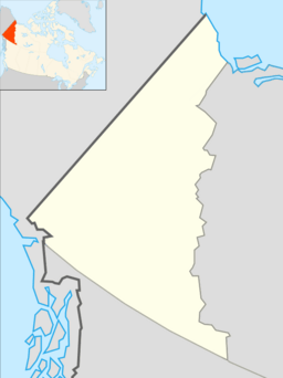
Ts'oogot Gaay Lake is a special lake located in the far western part of Canada. It's found in the Yukon territory, right near the border with Alaska. This beautiful lake is a great example of the wild nature you can find in Canada's north.
About Ts'oogot Gaay Lake
Ts'oogot Gaay Lake is one of the most western lakes in all of Canada. It sits in the southwest corner of the Yukon. The lake is very close to Beaver Creek, which is a town right on the border with Alaska. You can find it about 30 kilometres (19 mi) northwest of Beaver Creek, along the famous Alaska Highway.
The lake is 567 metres (1,860 ft) (about 1,860 feet) above sea level. It covers an area of about .18 km2 (0.069 sq mi), which is roughly the size of 35 football fields.
Nearby Lakes and Land
Ts'oogot Gaay Lake is part of a group of lakes. These include Ch'į̀hjiit Lake, Dlaałäl Lake, and Mänh Ts'eek. The tallest point nearby is a hill about 792 m (2,598 ft) (2,598 feet) high. This hill is located about 2.1 km (1.3 mi) (1.3 miles) west of Ts'oogot Gaay Lake.
The lake itself stretches about 1.2 kilometres (0.75 mi) (0.75 miles) from north to south. It is about 0.8 km (0.50 mi) (0.5 miles) wide from east to west.
What's the Weather Like?
The area around Ts'oogot Gaay Lake has a cool climate. The plants you see there are mostly thin, low-growing forests. This type of forest is common in subarctic regions, which are just below the Arctic.
The average temperature for the whole year in this valley is about −5 °C (23 °F) (23°F). The warmest month is July, when the average temperature is around 14 °C (57 °F) (57°F). The coldest month is January, with an average temperature of about −24 °C (−11 °F) (-11°F).
 | Jewel Prestage |
 | Ella Baker |
 | Fannie Lou Hamer |


