Twain Harte Dam facts for kids
Quick facts for kids Twain Harte Dam |
|
|---|---|
|
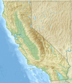
Location of Twain Harte Dam in California#USA
|
|
| Coordinates | 38°1′43.04″N 120°14′37.44″W / 38.0286222°N 120.2437333°W |
| Opening date | 1928 |
The Twain Harte Dam (National ID # CA00649) is a special type of arch dam located in Tuolumne County, California. It helps create the beautiful Twain Harte Lake, which is near the town of Twain Harte, California.
Contents
Building the Twain Harte Dam
Work on the Twain Harte Dam started in the summer of 1927. It was finished and opened in 1928. The Twain Harte Lake Association owns and takes care of the dam.
Dam Dimensions and Size
The dam is about 36 feet (11 m) tall, which is like a three-story building. It stretches 325 feet (99 m) across, which is longer than a football field. At its top, the dam is 8 feet (2.4 m) wide. The highest point of the dam is 3,509.8 feet (1,069.8 m) above sea level. The dam is made of a lot of material, about 1,197 cubic yards (915 m3) of it!
Twain Harte Lake: The Reservoir
Twain Harte Lake is the name of the water body held back by the Twain Harte Dam. It's a reservoir, which is like a big, artificial lake.
Lake Size and Use
The lake usually covers about 12 acres (4.9 ha) of land. When it's full, it can hold up to 143 acre-feet (176,000 m3) of water. The water that fills the lake comes from a surrounding area of 1.04 square miles (2.7 km2). People use Twain Harte Lake for fun activities like swimming and boating. However, only members of the Twain Harte Lake Association can use the lake.
Safety Concerns at the Dam
In August 2014, there was a safety issue near the dam. A large rock formation next to the dam, known as "the Rock," started to crack.
Why the Lake Was Drained
People were worried that the dam might break because of the cracking rock. If the dam broke, it could cause a sudden flood in Sullivan Creek. To keep everyone safe, the lake was closed and drained. The cracking of the rock is a natural process called exfoliation, where layers of rock peel away.
 | John T. Biggers |
 | Thomas Blackshear |
 | Mark Bradford |
 | Beverly Buchanan |


