
Tuolumne County, California facts for kids
Quick facts for kids
Tuolumne County, California
|
|||
|---|---|---|---|
| County of Tuolumne | |||
   Images, from top down, left to right: the Old Tuolumne County Courthouse in Sonora, a shop in Columbia State Historic Park, Tuolumne Meadows in Yosemite National Park
|
|||
|
|||

Location in the state of California
|
|||
| Country | United States | ||
| State | California | ||
| Regions | Sierra Nevada, Gold Country | ||
| Incorporated | February 15, 1850 | ||
| County seat | Sonora | ||
| Largest city | Sonora | ||
| Government | |||
| • Type | Council–Administrator | ||
| • Body | Board of Supervisors | ||
| Area | |||
| • Total | 2,274 sq mi (5,890 km2) | ||
| • Land | 2,221 sq mi (5,750 km2) | ||
| • Water | 54 sq mi (140 km2) | ||
| Highest elevation | 13,114 ft (3,997 m) | ||
| Population | |||
| • Total | 55,620 | ||
| • Density | 24.459/sq mi (9.4437/km2) | ||
| GDP | |||
| • Total | $2.884 billion (2022) | ||
| Time zone | UTC−8 (Pacific Time Zone) | ||
| • Summer (DST) | UTC−7 (Pacific Daylight Time) | ||
| Congressional district | 5th | ||


Tuolumne County (![]() i/tuˈɒləmi/) is a county in the state of California. As of 2020, about 55,620 people live here. The main city and county seat is Sonora. It is the only city in the county.
i/tuˈɒləmi/) is a county in the state of California. As of 2020, about 55,620 people live here. The main city and county seat is Sonora. It is the only city in the county.
Tuolumne County is part of the Sonora, California, Micropolitan Statistical Area. This area is in the Sierra Nevada mountains. The northern part of Yosemite National Park is also located in the eastern part of the county.

Contents
- What's in a Name? The Meaning of Tuolumne
- A Look Back: The History of Tuolumne County
- Exploring the Land: Geography of Tuolumne County
- Getting Around: Transportation in Tuolumne County
- Who Lives Here? Demographics of Tuolumne County
- Places to Live: Communities in Tuolumne County
- Images for kids
- See also
What's in a Name? The Meaning of Tuolumne
The name Tuolumne comes from Native American languages. It has a few possible meanings. Some say it means "Many Stone Houses." Others believe it means "The Land of Mountain Lions."
One idea from William Fuller, a Native American Chief, is that it means "Straight Up Steep." A report from Mariano Vallejo to the first California State Legislature said the word comes from talmalamne. This word means "cluster of stone wigwams." It might also mean "people who live in stone houses," like caves.
A Look Back: The History of Tuolumne County
Tuolumne County was one of California's first 27 counties. It was officially formed in 1850. Before it got its official name, people sometimes called it Oro County.
The first borders of Tuolumne County changed over time. In 1854 and 1855, a part of the county in the west became Stanislaus County. Later, in 1864, some land from Tuolumne and other counties helped create Alpine County. By 1872, the county's borders were mostly set as they are today.
Exploring the Land: Geography of Tuolumne County
Tuolumne County covers about 2,274 square miles (5,890 square kilometers). Most of this area, about 2,221 square miles (5,750 square kilometers), is land. The rest, about 54 square miles (140 square kilometers), is water.
A large part of the county includes federal lands. These are areas managed by the U.S. government. They include parts of Yosemite National Park and Stanislaus National Forest. There are also lands managed by the Bureau of Land Management and Indian reservations. A well-known landform in the county is Table Mountain.
Neighboring Counties
Tuolumne County shares its borders with several other counties:
- Alpine County, California - to the north
- Calaveras County, California - to the northwest
- Stanislaus County, California - to the southwest
- Mariposa County, California - to the south
- Madera County, California - to the southeast
- Mono County, California - to the east
- Merced County, California - to the southwest
Natural Features and Protected Areas
Tuolumne County has many interesting natural features:
- Red Hills (Tuolumne County) is a special area protected for its environment.
- Stanislaus National Forest is a large protected forest.
- Yosemite National Park is a famous national park.
The county also has beautiful valleys:
- Grand Canyon of the Tuolumne
- Lone Gulch
- Tiltill Valley
Getting Around: Transportation in Tuolumne County
Main Roads
Several important highways run through Tuolumne County:
 California State Route 49
 California State Route 108
 California State Route 120
Public Transport
Tuolumne County Transit offers bus routes from Sonora to many parts of the county. You can connect to Calaveras County Transit from Columbia. However, there is no public transport that connects Tuolumne County to bigger cities nearby.
During summer, the Yosemite Area Regional Transportation System (YARTS) offers one daily trip from Sonora into Yosemite Valley.
Airports
Tuolumne County has two airports for smaller planes:
- Columbia Airport
- Pine Mountain Lake Airport
Who Lives Here? Demographics of Tuolumne County
| Historical population | |||
|---|---|---|---|
| Census | Pop. | %± | |
| 1850 | 8,351 | — | |
| 1860 | 16,229 | 94.3% | |
| 1870 | 8,150 | −49.8% | |
| 1880 | 7,848 | −3.7% | |
| 1890 | 6,082 | −22.5% | |
| 1900 | 11,166 | 83.6% | |
| 1910 | 9,979 | −10.6% | |
| 1920 | 7,768 | −22.2% | |
| 1930 | 9,271 | 19.3% | |
| 1940 | 10,887 | 17.4% | |
| 1950 | 12,584 | 15.6% | |
| 1960 | 14,404 | 14.5% | |
| 1970 | 22,169 | 53.9% | |
| 1980 | 33,928 | 53.0% | |
| 1990 | 48,456 | 42.8% | |
| 2000 | 54,501 | 12.5% | |
| 2010 | 55,365 | 1.6% | |
| 2020 | 55,620 | 0.5% | |
| 2023 (est.) | 54,204 | −2.1% | |
| U.S. Decennial Census 1790-1960 1900-1990 1990-2000 2010 2020 |
|||
The population of Tuolumne County has changed over the years. In 2020, the county had 55,620 people. Most residents are White. About 12.8% of the population is of Hispanic or Latino background.
In 2000, the average age in the county was 43 years old. About 20.7% of the people were under 18. The median income for a household was $38,725. This means half of the households earned more than that, and half earned less. About 11.4% of the population lived below the poverty line.
Places to Live: Communities in Tuolumne County
City
- Sonora is the main city and the county seat.
Census-Designated Places (CDPs)
These are areas that are like towns but are not officially incorporated as cities.
- Cedar Ridge
- Chinese Camp
- Cold Springs
- Columbia
- East Sonora
- Groveland
- Jamestown
- Long Barn
- Mi-Wuk Village
- Mono Vista
- Phoenix Lake
- Pine Mountain Lake
- Sierra Village
- Soulsbyville
- Strawberry
- Tuolumne
- Tuttletown
- Twain Harte
Other Communities
These are smaller areas that are not officially incorporated.
Images for kids
-
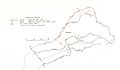
An old map showing Tuolumne County's boundaries.
-
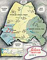
A map of Tuolumne County from 1935.


See also
 In Spanish: Condado de Tuolumne para niños
