Two Mile Square Reservation facts for kids
The Two Mile Square Reservation was a special piece of land in Ohio. Native American tribes gave this land to the United States in a peace agreement called the Treaty of Greenville in 1795. This land was measured and divided differently from the areas around it. Later, plots of land were sold to new settlers.
Contents
How the Land Became a Reservation
A Big Battle and a Peace Treaty
In 1794, American forces won a major fight called the Battle of Fallen Timbers. This battle helped end a conflict known as the Northwest Indian War. After the battle, the Treaty of Greenville was signed. This treaty gave a large part of southern and eastern Ohio to the United States.
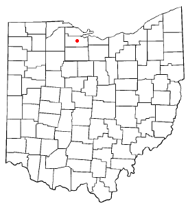
The treaty also set aside several other areas. One of these was the Two Mile Square Reservation. It was described as "One piece two miles square, at the lower rapids of the Sandusky river." Today, this area is part of Fremont, Ohio. It was located where two land sections, called townships, would have normally been.41°20′33″N 83°06′40″W / 41.34250°N 83.11111°W
Defending the Land During War
During the War of 1812, an important fort was built inside the reservation. This fort was named Fort Stephenson. In 1813, a young American officer named George Croghan successfully defended the fort. He and his troops bravely fought off attacks from British and Native American forces led by General Proctor.
How the Land Was Divided and Sold
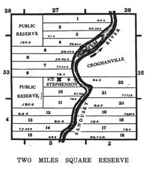
The United States government decided to survey this land in a special way. In 1807, a man named William Ewing divided the reservation into four square sections, each one mile by one mile. These sections were numbered one to four, starting in the northeast corner and going counter-clockwise.
Later, in 1816, Joseph Wampler surveyed the area again. He created 310 smaller plots (called "in-lots") and 63 larger plots (called "out-lots") in one section, specifically for a new town called Croghanville. He also set aside two areas for public use. A river island in one section was divided into two parts. The rest of the reservation was split into 22 "Fractional Sections." These sections were along the river and were about 80 acres each.
The land was put up for sale through a government office in Wooster. In 1829, the town of Croghanville became known as Lower Sandusky. Then, in 1848, its name was changed again to Fremont, which it is still called today.
 | John T. Biggers |
 | Thomas Blackshear |
 | Mark Bradford |
 | Beverly Buchanan |


