United States and Mexican Boundary Survey facts for kids
The United States and Mexican Boundary Survey (1848–1855) was a big project that figured out the exact border between the United States and Mexico. This border was decided after the Mexican–American War ended with a special agreement called the Treaty of Guadalupe Hidalgo.
The results of this survey were put into three books titled Report on the United States and Mexican boundary survey, made under the direction of the secretary of the Interior by William H. Emory (1857-1859). These books were not just about the border; they also had lots of information about nature, like plants, fish, birds, and other animals found in the area. The survey also helped the War Department (now known as the United States Department of War) gather information that could be used to plan a railroad line.
Contents
What Was the Border Survey?
The United States and Mexican Boundary Survey was a huge effort to draw a clear line between the two countries. This was important because the Mexican–American War had just ended, and a new border was agreed upon. Surveyors are people who measure land and make maps. Their job was to walk, ride, and explore the vast lands to mark where the new border would be.
Challenges Faced by the Survey Team
The survey wasn't easy! The team, led by William H. Emory, faced many problems. One big issue was not having enough money. This meant the workers sometimes didn't have enough food, especially as prices for goods went up around them. It was a tough situation for the men working hard in remote areas.
Money problems continued even after new funds were sent. Some of the money was taken by one of the new leaders of the project. This forced Emory to travel all the way to Washington D.C. himself to get more money for his team.
Even after Emory's trip, it took time for the money to reach the workers. This caused a lot of frustration, and some workers even started to protest and riot. The whole project stopped for a while. To fix this, Emory was given special power to get money directly from the government. He used this power to pay his team and get the survey back on track.
Encounters with Native Americans
The survey teams also had encounters with Native American groups in the areas they were exploring. Sometimes these encounters led to attacks, which made the work even more dangerous. Because of these dangers, the survey leaders asked the War Department for military escorts to protect the teams as they worked.

Nature and Art in the Report
The survey report was more than just maps and border lines. It was also a treasure chest of information about nature.
Amazing Animal Discoveries
One part of the report, called Zoology of the Boundary, focused on animals. It included 25 beautiful, hand-colored pictures of birds. These illustrations were made by a company in Philadelphia that also worked on famous bird books by John James Audubon. The report also had many drawings of plants, reptiles, and amphibians, some of which were also colored by hand.
Important Historical Pictures
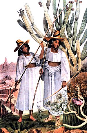
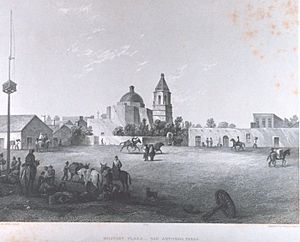
Besides animals and plants, the report also contained hand-colored pictures of the landscapes and the people living there, including Native American tribes. These pictures are very important because they show us what these areas and people looked like a long time ago. They are like a visual history book!
The International Boundary and Water Commission
Because of this important survey and other agreements, the U.S. and Mexico created a special group called the International Boundary and Water Commission (IBWC) in 1889. This group's job is to take care of the border, share river water between the two countries, and help control floods and keep water clean. For a long time, this group was seen as a great example of countries working together.
 | William M. Jackson |
 | Juan E. Gilbert |
 | Neil deGrasse Tyson |


