Villa Jiménez facts for kids
Quick facts for kids
Villa Jiménez
|
|
|---|---|

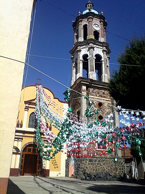
Temple in Caurio de Guadalupe, Jiménez
|
|
| Country | |
| State | |
| Municipality | Jiménez |
| Area | |
| • Total | 2.444 km2 (0.944 sq mi) |
| Elevation
(of seat)
|
2,006 m (6,581 ft) |
| Population
(2020 Census)
|
|
| • Total | 3,974 |
| • Density | 1,626.0/km2 (4,211.4/sq mi) |
| Time zone | UTC-6 (Central) |
| • Summer (DST) | UTC-5 (Central) |
| Postal codes |
58784
|
| Area code | 454 |
| Website | Official website: http://www.jimenezmich.gob.mx/ |
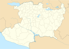
Villa Jiménez is a town in the Mexican state of Michoacán. It is the main town, or "municipal seat," of the Jiménez municipality.
The town is about 97 kilometers (60 miles) away from Morelia, which is the capital city of Michoacán. Villa Jiménez sits high up, at 2,006 meters (6,581 feet) above sea level.
The Story of Villa Jiménez
A long time ago, in the middle of the 1800s, people traveled by stagecoach. These coaches went between Zamora and Morelia. They had to cross the Ángulo River.
At this river crossing, a man named Patrocinio Aguilar lived. He sold food and supplies to the travelers. Because of him, the place became known as "Vado de Aguilar," which means "Aguilar's Ford." A "ford" is a shallow place in a river where you can cross.
On May 30, 1910, the settlement became an official town. It was renamed Villa Jiménez. This new name honored Mariano Jiménez, who was the governor of Michoacán from 1885 to 1892. A governor is like the leader of a state.
How Many People Live Here?
In 2020, the town of Villa Jiménez had 3,974 people living there. This number was a little less than in 2010. In 2010, there were 4,249 people.
This means the population went down a bit each year. For every square kilometer, there were about 1,626 people in 2020. This is called the population density.
What Do People Do for Work?
Most people in Jiménez work in agriculture. This means they grow crops and raise animals. The most important crop they grow is corn.
They also grow sorghum and forage oats. These are types of grains and plants used to feed animals. Farmers in Villa Jiménez also raise chickens, cattle (cows), and pigs.
See also
 In Spanish: Villa Jiménez para niños


