Waihorotiu Stream facts for kids

The Waihorotiu Stream (pronounced Why-ho-ro-tee-oo) is a stream in Auckland, New Zealand. Its Māori name, Wai Horotiu, means 'Horotiu's water'. This stream used to flow openly down the main street of Auckland, Queen Street. Today, it is hidden underground. The stream was covered up as the city grew and developed.
Waihorotiu's Journey
The Waihorotiu Stream was once an open waterway. It was one of many smaller streams that fed into the Waitemata Harbour. Millions of years ago, this stream carved out the valley where Queen Street now lies. The upper part of this valley is now Myers Park.
The stream flowed through a marshy area, which is now Aotea Square. From there, it continued north between Queen Street and Elliot Street. It then reached Victoria Street and flowed into what is now the lower part of Queen Street. The stream emptied into the harbour at a place now called Fort Street. In the past, this area was known as Fore Street, a shorter name for 'Foreshore'. The lower parts of the stream were affected by the ocean's tides. Māori people likely fished in this area long ago.
Life Around the Stream
The marshy area where Aotea Square is today was probably used by Māori to catch birds and eels. Another small stream, located between Wellesley Street and Airedale Street, might have provided drinking water. Both Māori villages and the first European settlers in Auckland may have used this water. There was also a spring near Waterloo Quadrant. This spring was later used by a company that made mineral water.
In Māori stories, the Waihorotiu Stream is home to Horotiu. Horotiu is a taniwha, which is like a local nature spirit.
How the Stream Changed
When Europeans first settled in Auckland, they built homes on higher ground. This included areas like Shortland Street and Albert Park Hill. But as more people arrived, the Queen Street valley began to fill with buildings. A large fire in the Shortland Street area also encouraged people to build in the valley.
Having an open stream in the middle of the road caused many problems. This was especially true before any proper sewer systems were built. The sides of the stream would crumble when it rained. There were only a few places to cross, sometimes just simple wooden planks. People and carriages would sometimes fall into the stream. It became very dirty, almost like an open sewer.
Around the mid-1800s, a surveyor named Charles Ligar tried to fix the stream. He built strong walls to control its flow. This project was called the Ligar Canal. However, it did not work well. People called it "a terrible, smelly ditch" that collected all kinds of rubbish.
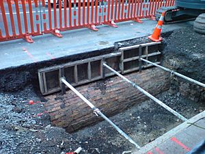
Eventually, the stream was covered over with bricks. It became an underground sewer. Even today, water from under Myers Park still flows into this old drain. It travels under Queen Street and empties into the sea near the Ferry Building.
Ideas for the Future
In 2011, a local artist suggested a new idea. They proposed that the stream could be uncovered again. This would be part of the city's plan to make the inner city more friendly for people. The stream could become a beautiful central feature once more.
 | Tommie Smith |
 | Simone Manuel |
 | Shani Davis |
 | Simone Biles |
 | Alice Coachman |

