
Waltham, New Zealand facts for kids
Quick facts for kids
Waltham
|
|
|---|---|
|
Suburb
|
|

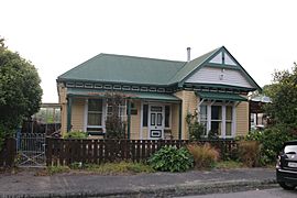
Houses on Laurence Street
|
|

Waltham
Location in New Zealand
|
|
| Country | New Zealand |
| Local authority | Christchurch |
| Electoral ward |
|
| Area | |
| • Land | 206 ha (509 acre) |
| Population
(June 2023)
|
|
| • Total | 3,930 |
|
|
||
Waltham is a suburb in Christchurch, New Zealand. It's about 2 kilometers (1.2 miles) south-east of the city center.
A main road, State Highway 76 (also called Brougham Street), goes through Waltham. It's part of Christchurch's main road system. The Lyttelton Line railway also runs through the area.
Waltham is surrounded by roads like Waltham Road, Moorhouse Avenue, Ferry Road, and Ensors Road. The Ōpāwaho / Heathcote River is also a boundary. Waltham used to be part of the Sydenham area. It became part of Christchurch City in 1903.
In the 1980s, some people tried to name the western part of Waltham "Charleston." This was to keep it residential and stop more factories from being built. Today, that area is sometimes called Waltham and sometimes Charleston.
The suburb of Waltham has both homes and businesses. You'll find light and heavy industries here.
Contents
History of Waltham
An early settler in Christchurch, Charles Prince, owned a large house called Waltham House. It was on Colombo Street South. In 1866, people from the area met at his house. They all agreed to name their district "Waltham."
The Christchurch gasworks used to be on the edge of Waltham. It closed down around 1980.
Waltham also had a malt works and many warehouses on Waltham Road. These buildings were taken down after the 2011 Christchurch earthquakes. In their place, 88 new homes were built. These homes have two or three bedrooms.
People and Population
Waltham is divided into three areas for counting people: Waltham, Charleston, and Lancaster Park. Waltham and Charleston are mostly residential, meaning people live there. Lancaster Park is an L-shaped area that goes north to Cashel Street.
How Many People Live Here?
The residential parts of Waltham (Waltham and Charleston areas) cover about 0.95 square kilometers. As of 2023, about 3,339 people live in these areas. This means there are about 3,515 people per square kilometer.
The population has grown over the years:
- In 2006: 2,922 people
- In 2013: 3,012 people
- In 2018: 3,339 people
In 2018, there were 1,461 households. There were more males (1,725) than females (1,614). About 14% of the people were under 15 years old. Many people were between 30 and 64 years old (46.7%).
Different Backgrounds
Waltham is a diverse place. Here's a look at the different groups of people in 2018:
- 69.6% were European/Pākehā
- 13.7% were Māori
- 6.5% were Pasifika
- 18.3% were Asian
- 4.2% were from other backgrounds
About 31.9% of people in Waltham were born overseas. This is higher than the national average for New Zealand (27.1%).
Beliefs and Work
When asked about religion in 2018:
- 50.1% said they had no religion.
- 31.4% were Christian.
- Smaller numbers followed Hinduism, Islam, Buddhism, or other religions.
For those aged 15 and older, about 22% had a university degree or higher. About 18.5% had no formal qualifications. Most people (56.2%) worked full-time.
Lancaster Park Area
The Lancaster Park area is about 1.12 square kilometers. As of 2023, about 243 people live there.
In 2018, there were 72 households. The median age was 34.7 years. About 9.9% of people were under 15. The population in Lancaster Park has changed:
- 2006: 258 people
- 2013: 219 people
- 2018: 243 people
The ethnic groups in Lancaster Park in 2018 included:
About 44.4% of people in Lancaster Park were born overseas.
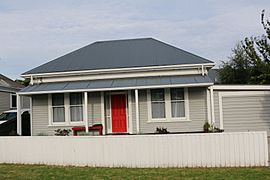
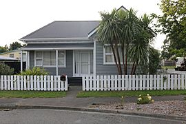
- Cottages typical of the suburb of Waltham (2022)
-
-
-


Education in Waltham
Waltham has two schools that serve the community.
- Waltham School is a primary school for students in years 1 to 8. It opened in 1891 and currently has 204 students.
- Te Kura Kaupapa Māori o Waitaha is a school for all ages, from years 1 to 13. It teaches in the Māori language. This school was started in 1987 and has 219 students.
Both schools are coeducational, meaning they teach both boys and girls. They are state schools, which means they are funded by the government.
Waltham Summer Pool
The Waltham swimming pools were badly damaged during the 2011 Christchurch earthquakes. After a lot of repair work, the pools reopened in January 2015. The repairs cost about $3.2 million dollars.
The work included:
- New signs
- An updated plant room (where pool equipment is kept)
- New fences
- Painting
- Landscaping (making the outdoor areas look nice)
- New roofing
The outdoor pools are open every summer. The complex has a large 33-meter swimming pool with nine lanes. There's also a smaller pool for toddlers and a fun waterslide.
