Wauneta, Kansas facts for kids
Quick facts for kids
Wauneta, Kansas
|
|
|---|---|

|
|
| Country | United States |
| State | Kansas |
| County | Chautauqua |
| Elevation | 961 ft (293 m) |
| Time zone | UTC-6 (CST) |
| • Summer (DST) | UTC-5 (CDT) |
| Area code | 620 |
| FIPS code | 20-76025 |
| GNIS ID | 484426 |
Wauneta is a small, unincorporated community located in Chautauqua County, Kansas, United States. An "unincorporated community" means it's a place where people live, but it doesn't have its own local government like a city or town. Instead, it's governed by the county.
What is Wauneta's History?
Wauneta used to be a busier place! It once had its own post office, which helped people send and receive mail. This post office closed its doors in 1961.
Besides the post office, Wauneta also had important local businesses. There was a grocery store where people could buy food and supplies. It also had a gas station for cars and an auto repair shop to fix vehicles. These places were important for the people living in and around Wauneta.
Where is Wauneta Located?
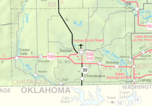
Wauneta is found in the southeastern part of Kansas. It's in Chautauqua County. The community is located at 37°06′47″N 96°22′50″W / 37.11306°N 96.38056°W. This means it's in the Central Time Zone, just like many other places in the middle of the United States.
 | William M. Jackson |
 | Juan E. Gilbert |
 | Neil deGrasse Tyson |


