Western Chain (New Zealand) facts for kids
|
Tahi, Rua, Toru, Whā, Rima (Māori)
|
|
|---|---|

The position of The Snares relative to New Zealand
|
|
| Geography | |
| Coordinates | 48°03′0″S 166°30′30″E / 48.05000°S 166.50833°E |
| Archipelago | The Snares |
| Length | 1.2 km (0.75 mi) |
| Highest elevation | 44 m (144 ft) |
| Administration | |
| Demographics | |
| Population | 0 |
The Western Chain is a small group of islands. These tiny islands are part of a larger group called The Snares. They are located far to the south of New Zealand.
Where is the Western Chain?
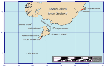
The Western Chain islands are found at 48°03′0″S 166°30′30″E / 48.05000°S 166.50833°E. They are about 5 kilometers (3 miles) southwest of the main island of The Snares. This main island is called North East Island.
The Snares Islands are quite remote. They are about 200 kilometers (124 miles) south of New Zealand's South Island. The Western Chain itself stretches for about 2 kilometers (1.2 miles) in a northwest direction.
What are the islands like?
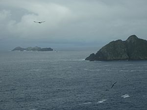
The islands of the Western Chain are not very big. The highest point on any of these islets is 44 meters (144 feet) above sea level. This highest spot is found on the southernmost island in the chain.
No people live on these islands. They are important for wildlife, especially birds.
What are their names?
Each of the islets in the Western Chain has a special name. These names come from the Māori language. They are named in order from northeast to southwest.
The names are:
- Tahi (meaning One)
- Rua (meaning Two)
- Toru (meaning Three)
- Whā (meaning Four)
- Rima (meaning Five)
These names help people identify each small island in the chain.
 | Percy Lavon Julian |
 | Katherine Johnson |
 | George Washington Carver |
 | Annie Easley |


