Wickham River facts for kids
Quick facts for kids Wickham |
|
|---|---|
|
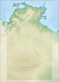
Location of the Wickham River mouth in the Northern Territory
|
|
| Country | Australia |
| Territory | Northern Territory |
| Region | Victoria Bonaparte (IBRA) |
| Physical characteristics | |
| Main source | Mount Kimon 330 m (1,080 ft) |
| River mouth | Victoria River 74 m (243 ft) 17°01′31″S 129°57′52″E / 17.02528°S 129.96444°E |
| Length | 198 km (123 mi) |
| Width |
|
| Basin features | |
| Basin size | 5,018 km2 (1,937 sq mi) |
| Tributaries |
|
| National park | Judbarra / Gregory NP |
The Wickham River is a special river in the Northern Territory of Australia. It's called an ephemeral river because it only flows for part of the year. You can find it in the Victoria Bonaparte area.
Contents
River's Journey and What You'll Find
The Wickham River starts high up on rocky hills and a sandstone plateau. It begins on the southeastern side of Mount Kimon. The river then flows mostly towards the northeast.
Along its way, seven smaller streams join the Wickham River. These include the Humbert River, Soda Springs Creek, Depot Creek, and Broadarrow Creek. It also flows through a permanent waterhole called Johnston Billabong.
Finally, the Wickham River meets the Victoria River. This meeting point is south of the Fitzgerald Range, near a place called Pompey Knob. The Wickham River drops about 256 meters over its 198-kilometer journey.
When the River Flows
The Wickham River only flows for about six months each year. This happens during the wet season in the Northern Territory. During the dry season, the riverbed becomes a string of waterholes. Some of these waterholes are fed by underground springs, so they almost never dry up.
Judbarra / Gregory National Park
A large part of the area where the Wickham River collects its water is inside the Judbarra / Gregory National Park. This park was created in 1981. In 1996, the park's boundaries were made even bigger to include Mount Sanford.
History and Local People
In 1905, a surveyor named Lawrence Wells set up his base camp on the Wickham River. This was close to the Victoria River Downs Station homestead. He was there to map out the Northern Territory.
The land around the Wickham River has long been home to Aboriginal people. The traditional owners of this area are the community of Yarralin, also known as Walangeri.
Why is it Called Wickham River?
The river is named after Captain John Clements Wickham. He was a sailor who explored the Victoria River in 1839. He sailed about 200 kilometers up the Victoria River on his ship, HMS Beagle.
 | Toni Morrison |
 | Barack Obama |
 | Martin Luther King Jr. |
 | Ralph Bunche |


