Wungong Regional Park facts for kids
Quick facts for kids Wungong Regional Park |
|
|---|---|

Wungong Regional Park
|
|
| Type | Regional park |
| Location | City of Armadale |
| Established | 2008 |
| Administered by | Department of Biodiversity, Conservation and Attractions |
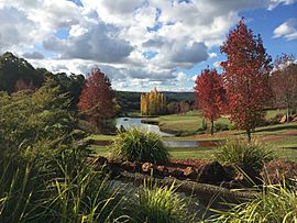
Wungong Regional Park is a special nature area located near Bedfordale in the Perth Hills. It's about 20 kilometres south-east of Perth, Western Australia, and is part of the City of Armadale. This park is a place where nature is protected and cared for.
About Wungong Regional Park
Wungong Regional Park got its name from the old townsite of Wungong, which was set up in 1909. The town itself was named after the Wungong Brook, a stream that European explorers first found in 1835.
In 2008, the park's name was officially confirmed. At the same time, three other regional parks and three national parks in the area were also renamed. These new names were chosen to honor the Aboriginal heritage of the land.
Wungong is one of eleven regional parks found around the Perth area in Western Australia. These parks are like green spaces in or near cities. They help protect and bring back important cultural history and amazing natural places. They also encourage people to enjoy nature in a way that doesn't harm the environment.
What Makes Up the Park
Wungong Regional Park is made up of several different natural areas. These include:
- Armadale Settlers Common, located in Bedfordale
- Bungendore Park, also in Bedfordale
- Churchman’s Bushland, found near Roleystone
- Parts of the Jarrahdale State Forest
- Wungong Valley, which is also in Bedfordale
These different sections work together to form the larger Wungong Regional Park. They help protect a variety of plants, animals, and natural landscapes.
 | James Van Der Zee |
 | Alma Thomas |
 | Ellis Wilson |
 | Margaret Taylor-Burroughs |

