Wye and Crundale Downs facts for kids
| Site of Special Scientific Interest | |

Wye Downs
|
|
| Area of Search | Kent |
|---|---|
| Interest | Biological Geological |
| Area | 358.3 hectares (885 acres) |
| Notification | 1989 |
| Location map | Magic Map |
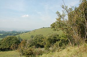
Wye and Crundale Downs is a very special natural area in Kent, England. It covers about 358 hectares, which is like 885 football fields! This amazing place is important for both its wildlife and its unique geology. It's located east of Ashford.
This area has many special protections. It's a Site of Special Scientific Interest (SSSI) because of its rare plants, animals, and geological features. It's also a Special Area of Conservation and part of the beautiful Kent Downs Area of Outstanding Natural Beauty. Some parts are even National Nature Reserves, which are places set aside to protect nature.
What Makes Wye and Crundale Downs Special?
Wye and Crundale Downs is a fantastic place to explore nature. It has many different types of natural environments, called habitats. These include:
- Grassy areas
- Wet meadows with special plants (calcareous fen meadow)
- Bushy areas (scrub)
- Dry woodlands growing on chalk
- Wet woodlands with alder trees
These different habitats mean that many different kinds of plants and animals can live here. It's like a big, natural puzzle with all the pieces fitting together!
The Devil's Kneading Trough
One of the most interesting parts of Wye and Crundale Downs is a geological site called the Devil's Kneading Trough. This place is super important for understanding Earth's history.
How the Landscape Changed
The Devil's Kneading Trough shows us how the land was shaped by very cold conditions. This happened during the last Ice Age, thousands of years ago. Back then, the weather was much colder, and ice and freezing conditions changed the landscape. Scientists call these changes "periglacial" changes. Studying this area helps us learn about what the Earth was like long, long ago.
 | Sharif Bey |
 | Hale Woodruff |
 | Richmond Barthé |
 | Purvis Young |

