Điện Biên province facts for kids
Quick facts for kids
Điện Biên
|
||
|---|---|---|
|
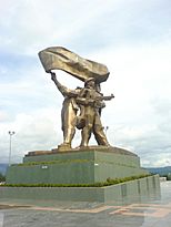
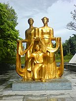
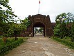
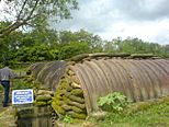
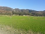
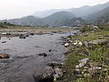
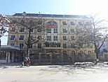
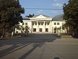
Relic Battle of Điện Biên Phủ • View of the mountains on way from Điện Biên Phủ to Sơn La • Mường Lay skyline • Field in Điện Biên Phủ City • A Water stream in Mường Chà • Phadin Hotel • The local community center in Mường Chà
|
||
|
||
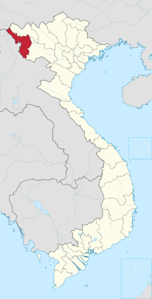
Location of Điên Biên within Vietnam
|
||
| Country | ||
| Region | Northwest | |
| Capital | Điện Biên Phủ | |
| Subdivision | 1 city, 8 rural districts and one town | |
| Government | ||
| • Type | Province | |
| • Body | Điện Biên Provincial People's Council | |
| Area | ||
| • Province | 9,539.93 km2 (3,683.39 sq mi) | |
| Population
(2024)
|
||
| • Province | 656,700 | |
| • Density | 68.837/km2 (178.287/sq mi) | |
| • Urban | 95,000 | |
| Ethnic groups | ||
| • Mông | 38.12% | |
| • Thái | 35.69% | |
| • Vietnamese | 17.38% | |
| • Khơ Mú | 3.30% | |
| • Dao | 1.11% | |
| • Others | 4.4% | |
| GDP | ||
| • Province | VND 15.750 trillion US$ 0.684 billion |
|
| Time zone | UTC+7 (ICT) | |
| Area codes | 215 | |
| ISO 3166 code | VN-71 | |
| HDI (2020) | (61st) |
|
Điện Biên is a province located in the Northwest part of Vietnam. Its name means "stable frontier," which makes sense because it's on the border with other countries. To the northeast, it shares a border with Lai Châu, and to the southeast, with Sơn La. It also borders China to the northwest and Laos to the west.
Điện Biên covers an area of about 9,539.93 square kilometers (about 3,683 square miles). As of 2024, around 656,700 people live there.
Contents
History of Điện Biên
The area of Điện Biên has a long and interesting history.
Early Settlers and Ancient Sites
The name "Điện Biên" means "stable frontier." This name refers to its location on the border between the old kingdoms of Lan Xang and Vietnam. You can find ancient sites in Điện Biên, like the Thẩm Khương and Thẩn Búa caves in Tuần Giáo. The first people to live here were the Ai Lao or Tai people. They are the direct ancestors of the Lao people who live in Laos today. Many village and town names still use words from the Tai language, like "Mường" (which means city) and "Tham" (which means cave).
Control by Different Groups
- 9th and 10th Centuries: The Lự group in Mường Thanh were very advanced for their time. They controlled a large area, including Sìn Hồ, Mường Lay, and Tuần Giáo.
- 11th and 12th Centuries: Later, Tai people (who are different from the Thai people of Thailand) came from Mường Ôm and Mường Ai. They took over Mường Lò in Nghĩa Lộ and Mường Thanh in Điện Biên. Eventually, they gained control of the entire region between Mường Lò and Mường Thanh.
Places to See
Điện Biên has many interesting places to visit, from ancient caves to important historical sites.
Chua Ta Cave
Chua Ta cave is a special place located almost 1,000 meters (about 3,280 feet) above sea level. It's found in a limestone mountain range that formed over millions of years. This cave, in Muong Dun commune, Tua Chua district, is recognized as a national heritage site. What makes Chua Ta cave unique is that it has two types of ecosystems: a limestone mountain ecosystem and a cave ecosystem. This means you can see a wide variety of nature here.
Climate in Điện Biên
Điện Biên province has a humid subtropical climate. This means it generally has hot, humid summers and mild winters.
| Climate data for Điện Biên Phủ, elevation 479 m (1,572 ft) | |||||||||||||
|---|---|---|---|---|---|---|---|---|---|---|---|---|---|
| Month | Jan | Feb | Mar | Apr | May | Jun | Jul | Aug | Sep | Oct | Nov | Dec | Year |
| Record high °C (°F) | 32.4 (90.3) |
35.0 (95.0) |
36.1 (97.0) |
38.5 (101.3) |
38.6 (101.5) |
37.9 (100.2) |
36.0 (96.8) |
36.0 (96.8) |
35.0 (95.0) |
35.5 (95.9) |
34.0 (93.2) |
31.1 (88.0) |
38.6 (101.5) |
| Mean daily maximum °C (°F) | 23.8 (74.8) |
26.2 (79.2) |
29.0 (84.2) |
31.0 (87.8) |
31.7 (89.1) |
31.1 (88.0) |
30.4 (86.7) |
30.4 (86.7) |
30.5 (86.9) |
29.2 (84.6) |
26.7 (80.1) |
23.9 (75.0) |
28.6 (83.5) |
| Daily mean °C (°F) | 16.5 (61.7) |
18.3 (64.9) |
21.0 (69.8) |
23.8 (74.8) |
25.5 (77.9) |
26.3 (79.3) |
25.9 (78.6) |
25.6 (78.1) |
24.9 (76.8) |
22.9 (73.2) |
19.7 (67.5) |
16.5 (61.7) |
22.2 (72.0) |
| Mean daily minimum °C (°F) | 12.5 (54.5) |
13.5 (56.3) |
15.8 (60.4) |
19.3 (66.7) |
21.7 (71.1) |
23.4 (74.1) |
23.3 (73.9) |
23.0 (73.4) |
21.7 (71.1) |
19.4 (66.9) |
15.7 (60.3) |
12.4 (54.3) |
18.5 (65.3) |
| Record low °C (°F) | −1.3 (29.7) |
4.8 (40.6) |
5.3 (41.5) |
11.6 (52.9) |
14.8 (58.6) |
17.4 (63.3) |
18.7 (65.7) |
10.7 (51.3) |
14.2 (57.6) |
7.7 (45.9) |
4.0 (39.2) |
0.4 (32.7) |
−1.3 (29.7) |
| Average precipitation mm (inches) | 26.0 (1.02) |
30.3 (1.19) |
64.1 (2.52) |
133.8 (5.27) |
222.9 (8.78) |
305.3 (12.02) |
359.6 (14.16) |
324.8 (12.79) |
168.6 (6.64) |
71.7 (2.82) |
44.1 (1.74) |
26.0 (1.02) |
1,784.3 (70.25) |
| Average rainy days | 5.7 | 5.4 | 7.5 | 13.7 | 17.9 | 22.0 | 24.4 | 22.3 | 15.6 | 10.1 | 6.8 | 4.6 | 155.9 |
| Average relative humidity (%) | 82.4 | 80.2 | 80.2 | 81.7 | 82.2 | 83.9 | 86.4 | 87.5 | 86.3 | 84.2 | 83.1 | 83.1 | 83.4 |
| Mean monthly sunshine hours | 159.8 | 177.3 | 198.4 | 202.0 | 202.3 | 141.3 | 132.7 | 148.6 | 168.4 | 170.5 | 160.5 | 160.0 | 2,025.4 |
| Source: Vietnam Institute for Building Science and Technology | |||||||||||||
| Climate data for Pha Din, elevation 1,347 m (4,419 ft) | |||||||||||||
|---|---|---|---|---|---|---|---|---|---|---|---|---|---|
| Month | Jan | Feb | Mar | Apr | May | Jun | Jul | Aug | Sep | Oct | Nov | Dec | Year |
| Record high °C (°F) | 29.3 (84.7) |
31.8 (89.2) |
36.0 (96.8) |
36.5 (97.7) |
36.6 (97.9) |
35.5 (95.9) |
36.0 (96.8) |
33.8 (92.8) |
32.6 (90.7) |
31.4 (88.5) |
31.2 (88.2) |
29.1 (84.4) |
36.6 (97.9) |
| Mean daily maximum °C (°F) | 17.2 (63.0) |
19.6 (67.3) |
22.7 (72.9) |
25.0 (77.0) |
25.2 (77.4) |
24.6 (76.3) |
24.2 (75.6) |
24.5 (76.1) |
24.2 (75.6) |
22.4 (72.3) |
19.7 (67.5) |
17.1 (62.8) |
22.2 (72.0) |
| Daily mean °C (°F) | 12.5 (54.5) |
14.5 (58.1) |
17.7 (63.9) |
20.0 (68.0) |
20.7 (69.3) |
20.8 (69.4) |
20.6 (69.1) |
20.6 (69.1) |
20.0 (68.0) |
18.1 (64.6) |
15.2 (59.4) |
12.4 (54.3) |
17.7 (63.9) |
| Mean daily minimum °C (°F) | 9.8 (49.6) |
11.3 (52.3) |
14.3 (57.7) |
16.6 (61.9) |
17.9 (64.2) |
18.7 (65.7) |
18.7 (65.7) |
18.6 (65.5) |
17.7 (63.9) |
15.8 (60.4) |
12.7 (54.9) |
10.0 (50.0) |
15.2 (59.4) |
| Record low °C (°F) | −0.4 (31.3) |
0.1 (32.2) |
−0.1 (31.8) |
5.9 (42.6) |
11.0 (51.8) |
13.1 (55.6) |
14.0 (57.2) |
15.0 (59.0) |
10.9 (51.6) |
8.3 (46.9) |
4.2 (39.6) |
−1.2 (29.8) |
−1.2 (29.8) |
| Average rainfall mm (inches) | 26.0 (1.02) |
30.3 (1.19) |
64.1 (2.52) |
133.8 (5.27) |
222.9 (8.78) |
305.3 (12.02) |
359.6 (14.16) |
324.8 (12.79) |
168.6 (6.64) |
71.7 (2.82) |
44.1 (1.74) |
26.0 (1.02) |
1,784.3 (70.25) |
| Average rainy days | 5.7 | 5.4 | 7.5 | 13.7 | 17.9 | 22.0 | 24.4 | 22.3 | 15.6 | 10.1 | 6.8 | 4.6 | 155.9 |
| Average relative humidity (%) | 81.4 | 75.8 | 71.1 | 75.5 | 83.0 | 89.7 | 91.4 | 90.5 | 86.9 | 86.0 | 83.9 | 81.9 | 83.2 |
| Mean monthly sunshine hours | 179.7 | 172.6 | 205.9 | 213.4 | 192.5 | 119.7 | 125.6 | 140.5 | 162.4 | 164.9 | 162.7 | 180.9 | 2,019.9 |
| Source: Vietnam Institute for Building Science and Technology | |||||||||||||
Administrative Divisions
Điện Biên province is divided into 10 main areas. These include one city, one town, and eight rural districts.
| Second Tier subdivisions |
Area (km²) |
Third Tier subdivisions | ||
|---|---|---|---|---|
| Ward | Township | Commune | ||
| Điện Biên Phủ city | 64.27 | 7 | 2 | |
| Mường Lay town | 114.03 | 2 | 1 | |
| Điện Biên District | 1639.85 | 25 | ||
| Điện Biên Đông District | 1206.39 | 1 | 13 | |
| Mường Ảng District | 443.52 | 1 | 9 | |
| Mường Chà District | 1199.42 | 1 | 11 | |
| Mường Nhé District | 1573.73 | 11 | ||
| Nậm Pồ District | 1498.00 | 15 | ||
| Tủa Chùa District | 679.41 | 1 | 11 | |
| Tuần Giáo District | 1136.29 | 1 | 18 | |
These areas are further divided into smaller parts. There are five commune-level towns, 116 rural communes, and nine wards.
Tourism and Attractions
Điện Biên is a great place for tourism, especially if you like history and nature.
Historical Sites
Many important historical places are found here. These include the headquarters of the Điện Biên Phủ Campaign in Mường Phăng. You can also visit old French strongholds like Him Lam and Độc Lập. Other key sites are hills A1, C1, E1, and the De Castries bunker. The Bản Phủ Citadel and the temple of Hoàng Công Chất are also popular spots.
Important monuments include the Điện Biên Phủ Victory Monument, which was opened in 2004. The Victory Museum, which tells the story of the battle, opened in 2014.
Natural Wonders
Điện Biên also has beautiful natural attractions. You can explore the Mường Nhé primeval forest, which is a very old and untouched forest. There are also caves like Pa Thơm and Thẩm Púa. If you like hot springs, you can visit Hua Pe and U Va. The province also has lovely lakes such as Pá Khoang and Pe Luông.
In the first half of 2018, Điện Biên welcomed about 490,000 tourists. This included 94,000 visitors from other countries. Tourism brought in nearly 644 billion Vietnamese Dong (VND) in revenue.
Other Places in Điện Biên
- Mường Thanh Valley
See also
 In Spanish: Provincia de Điện Biên para niños
 | Audre Lorde |
 | John Berry Meachum |
 | Ferdinand Lee Barnett |


