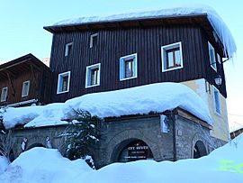
Abriès facts for kids
Quick facts for kids
Abriès
|
|
|---|---|
|
Part of Abriès-Ristolas
|
|

Town hall
|
|
| Country | France |
| Region | Provence-Alpes-Côte d'Azur |
| Department | Hautes-Alpes |
| Arrondissement | Briançon |
| Canton | Guillestre |
| Commune | Abriès-Ristolas |
| Area
1
|
77 km2 (30 sq mi) |
| Population
(2021)
|
285 |
| • Density | 3.701/km2 (9.59/sq mi) |
| Time zone | UTC+01:00 (CET) |
| • Summer (DST) | UTC+02:00 (CEST) |
| Postal code |
05460
|
| Elevation | 1,513–3,305 m (4,964–10,843 ft) (avg. 1,547 m or 5,075 ft) |
| 1 French Land Register data, which excludes lakes, ponds, glaciers > 1 km2 (0.386 sq mi or 247 acres) and river estuaries. | |
Abriès (in a local language called Vivaro-Alpine: Abrièrs) is a lovely place in southeastern France. It used to be its own town, called a "commune." But on January 1, 2019, it joined with another town, Ristolas. Now they are one bigger town called Abriès-Ristolas.
Abriès is part of the beautiful Queyras Regional Park. It sits in the valley of the Guil river. People love visiting Abriès for its amazing hiking trails. These trails are great for long or short walks. It's a quiet and natural area. Abriès also has a small ski resort where you can hit the slopes!
Exploring Abriès: Location and Mountains
Abriès is located in the Hautes-Alpes area of France. This region is known for its tall mountains. The land around Abriès is quite high up. Its lowest point is about 1,513 meters (4,964 feet) above sea level. The highest point reaches an impressive 3,305 meters (10,843 feet)!
For a long time, it was hard to get to Abriès. This was because of its location deep in the Guil valley. But even with its remote feel, Abriès has always been an important pathway. It connects Italy with the southern Alps in France.
People of Abriès: A Look at Population Changes
The number of people living in Abriès has changed a lot over time. Like many small mountain towns, its population has gone up and down. In the past, many more people lived there. Over the years, some people moved away.
However, in recent times, the population has started to grow again. This shows that Abriès is still a special place. People enjoy its natural beauty and peaceful environment. The chart below shows how the population has changed.
| Historical population | |||||||||||||||||||||||||||||||||||||||||||||||||||||||||||||||||||||||||||||||||||||||||||||||||||||||||||||||||||
|---|---|---|---|---|---|---|---|---|---|---|---|---|---|---|---|---|---|---|---|---|---|---|---|---|---|---|---|---|---|---|---|---|---|---|---|---|---|---|---|---|---|---|---|---|---|---|---|---|---|---|---|---|---|---|---|---|---|---|---|---|---|---|---|---|---|---|---|---|---|---|---|---|---|---|---|---|---|---|---|---|---|---|---|---|---|---|---|---|---|---|---|---|---|---|---|---|---|---|---|---|---|---|---|---|---|---|---|---|---|---|---|---|---|---|---|
|
|
||||||||||||||||||||||||||||||||||||||||||||||||||||||||||||||||||||||||||||||||||||||||||||||||||||||||||||||||||
| Source: EHESS (1793-1999) and INSEE | |||||||||||||||||||||||||||||||||||||||||||||||||||||||||||||||||||||||||||||||||||||||||||||||||||||||||||||||||||
See also
 In Spanish: Abriès para niños


