Acoyapa facts for kids
Quick facts for kids
Acoyapa
|
||
|---|---|---|
|
Municipality
|
||
|
||
| Country | ||
| Department | Chontales Department | |
| Area | ||
| • Municipality | 1,381.79 km2 (533.51 sq mi) | |
| Elevation | 99.90 m (327.76 ft) | |
| Population
(2022 estimate)
|
||
| • Municipality | 20,412 | |
| • Density | 14.7721/km2 (38.2597/sq mi) | |
| • Urban | 10,363 | |
Acoyapa is a town and a municipality in the Chontales Department of Nicaragua. A municipality is like a local government area. Its name comes from the word "Acoyaph," which means "place from above."
Where is Acoyapa?
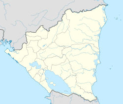
Acoyapa is located in the Chontales Department of Nicaragua. It shares its borders with several other municipalities. To the north, it borders Juigalpa, San Pedro de Lóvago, and Santo Tomás. To the east, it is next to Villa Sandino and El Coral. In the south, it borders El Almendro and Morrito. To the west, Acoyapa touches the large Lake Nicaragua. The main town center of Acoyapa is about 170 kilometers (about 106 miles) away from Managua, which is the capital city of Nicaragua.
Who Lives in Acoyapa?
As of a 2022 estimate, about 20,412 people live in Acoyapa. More than half of the people, about 50.4%, are females. The other 49.6% are males. About 50.8% of everyone living in Acoyapa lives in the town area, which is considered an urban area.
See also
 In Spanish: Acoyapa para niños
 | Selma Burke |
 | Pauline Powell Burns |
 | Frederick J. Brown |
 | Robert Blackburn |


