Akins, Oklahoma facts for kids
Quick facts for kids
Akins, Oklahoma
|
|
|---|---|

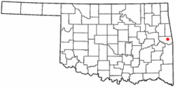
Location of Akins, Oklahoma
|
|
| Country | United States |
| State | Oklahoma |
| County | Sequoyah |
| Area | |
| • Total | 13.65 sq mi (35.36 km2) |
| • Land | 13.60 sq mi (35.22 km2) |
| • Water | 0.06 sq mi (0.14 km2) |
| Elevation | 600 ft (200 m) |
| Population
(2020)
|
|
| • Total | 405 |
| • Density | 29.78/sq mi (11.50/km2) |
| Time zone | UTC-6 (Central (CST)) |
| • Summer (DST) | UTC-5 (CDT) |
| FIPS code | 40-00900 |
| GNIS feature ID | 2407706 |
Akins is a small community located in Sequoyah County, Oklahoma, in the United States. It is known as a "census-designated place" (CDP). This means it's an area that looks like a town but doesn't have its own local government. Akins is part of the larger Fort Smith metropolitan area, which includes parts of both Arkansas and Oklahoma.
In 2020, about 405 people lived in Akins. Back in 2010, the population was 493.
A post office served the area from 1894 until 1943. It is believed that Akins was named after Robert Akins, who delivered mail there.
A very important historical place, Sequoyah's Cabin, is located just a couple of miles northeast of Akins. It's a national historic site.
Geography of Akins
Akins is located in eastern Oklahoma. The total area of the community is about 13.6 square miles (35.2 square kilometers). All of this area is land.
Population and People
| Historical population | |||
|---|---|---|---|
| Census | Pop. | %± | |
| 2020 | 405 | — | |
| U.S. Decennial Census | |||
In 2010, there were 493 people living in Akins. The community had about 197 homes. The average number of people living in each home was 2.74.
The people living in Akins were of different ages. About 29% of the population was under 18 years old. Around 11.4% of the people were 65 years old or older. The average age of people in Akins was 37 years.
See also
 In Spanish: Akins (Oklahoma) para niños
 | Kyle Baker |
 | Joseph Yoakum |
 | Laura Wheeler Waring |
 | Henry Ossawa Tanner |

