Sequoyah County, Oklahoma facts for kids
Quick facts for kids
Sequoyah County
|
|
|---|---|
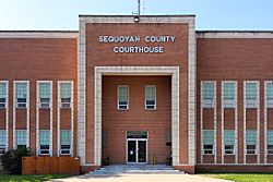
The Sequoyah County Courthouse in Sallisaw
|
|
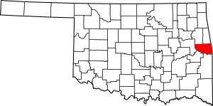
Location within the U.S. state of Oklahoma
|
|
 Oklahoma's location within the U.S. |
|
| Country | |
| State | |
| Founded | 1907 |
| Named for | Sequoyah |
| Seat | Sallisaw |
| Largest city | Sallisaw |
| Area | |
| • Total | 714 sq mi (1,850 km2) |
| • Land | 673 sq mi (1,740 km2) |
| • Water | 41 sq mi (110 km2) 5.7%% |
| Population
(2020)
|
|
| • Total | 39,281 |
| • Density | 58/sq mi (22/km2) |
| Congressional district | 2nd |
Sequoyah County is a county in the state of Oklahoma. In 2020, about 39,281 people lived here. The main town and county seat is Sallisaw.
Sequoyah County was formed in 1907 when Oklahoma became a state. It was named after Sequoyah, a famous Cherokee leader. He created the Cherokee syllabary, which is a writing system for the Cherokee language. Sequoyah County is also part of the Fort Smith area, which includes parts of Arkansas and Oklahoma.
Contents
History of Sequoyah County
People have lived in the area now known as Sequoyah County for a very long time. Scientists have found old sites from as far back as 6000 BC. These sites show that people lived here during the Archaic Period. More recent sites from 1000 to 1500 AD also show early villages.
Early European Influence
In the 1700s, French traders came to this region. They had trading posts in nearby Arkansas, which was part of their large colony called La Louisiane. Later, Spain claimed the area until 1800. Then, Napoleon of France took control again. He wanted to build a French empire in North America.
However, in 1803, Napoleon sold a huge amount of land to the United States. This sale was called the Louisiana Purchase. It included all French territory west of the Mississippi River. This meant Sequoyah County became part of the United States.
Native American Lands
Before the US bought the land, the powerful Osage Nation lived here. In 1816, the US bought some of their land. Around this time, some Cherokee people moved west from their homes in the Southeast. They settled on land given to them by the US. This area was then known as Lovely County, Arkansas Territory.
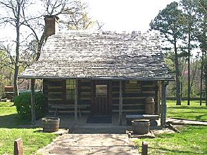
In 1829, the US government forced these Western Cherokee to move again. They were resettled in what was called Indian Territory. This is where Sequoyah County is today. Sequoyah himself moved to this area and built a cabin that you can still see. The Dwight Mission, a school and church, also moved here.
The Trail of Tears
In the late 1830s, the US government forced most of the Cherokee people to leave their homes in the Southeast. They had to walk a long, hard journey to Indian Territory. This difficult trip is known as the Trail of Tears. Many people died during this journey.
The Cherokee Nation set up its first capital at a place called Tahlonteskee. This was near the modern town of Gore, Oklahoma. Tahlonteskee was the capital until 1839. After that, Tahlequah became the capital. Tahlonteskee still remained an important meeting place for the "Old Settlers," who were the Western Cherokee.
Civil War Times
During the American Civil War, many Cherokee people in this area supported the Confederates. Many Cherokee owned enslaved people. They were also told that the Confederates would help them create a Native American state if they won the war. The only major fight in the county was on June 15, 1864. During this event, Colonel Stand Watie and his Confederate soldiers attacked a Union steamboat called the J. R. Williams on the Arkansas River.
Geography of Sequoyah County
Sequoyah County covers about 714 square miles. Most of this is land, about 673 square miles. The rest, about 41 square miles, is water.
The county has two main types of land. The northern part is in the Ozark Plateau, which has hills and forests. The southern part is in the Ouachita Mountains. The Cookson Hills are in the northwest. The Arkansas River forms the southern border of the county. Other important rivers and lakes include the Illinois River and Robert S. Kerr Reservoir.
Main Roads
- Interstate 40 runs east and west through Sequoyah County.
- U.S. 59 runs north and south through the county.
Neighboring Counties
Sequoyah County shares borders with several other counties:
- Cherokee County and Adair County (to the north)
- Crawford County, Arkansas (to the east)
- Sebastian County, Arkansas (to the southeast)
- Le Flore County (to the south)
- Haskell County (to the southwest)
- Muskogee County (to the west)
Protected Natural Areas
- Fort Smith National Historic Site (part of it is in the county)
- Sequoyah National Wildlife Refuge (part of it is in the county)
- Tenkiller State Park
Population and People
| Historical population | |||
|---|---|---|---|
| Census | Pop. | %± | |
| 1910 | 25,005 | — | |
| 1920 | 26,786 | 7.1% | |
| 1930 | 19,505 | −27.2% | |
| 1940 | 23,138 | 18.6% | |
| 1950 | 19,773 | −14.5% | |
| 1960 | 18,001 | −9.0% | |
| 1970 | 23,370 | 29.8% | |
| 1980 | 30,749 | 31.6% | |
| 1990 | 33,828 | 10.0% | |
| 2000 | 38,972 | 15.2% | |
| 2010 | 42,391 | 8.8% | |
| 2020 | 39,281 | −7.3% | |
| U.S. Decennial Census 1790-1960 1900-1990 1990-2000 2010-2019 |
|||
In 2020, the population of Sequoyah County was 39,281 people. This was a small decrease from 2010, when the population was 42,391.
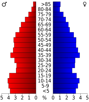
In 2000, there were about 14,761 households in the county. About 34% of these households had children under 18 living there. The average household had about 2.6 people. The median age in the county was 36 years old. This means half the people were younger than 36, and half were older.
Most people in Sequoyah County speak English. Some also speak Cherokee or Spanish as their first language.
Towns and Communities
City
- Sallisaw (This is the county seat, the main town where the county government is located.)
Towns
Other Communities
Unincorporated Communities
These are smaller communities that are not officially towns or cities.
Historic Places
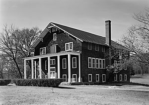
Many places in Sequoyah County are listed on the National Register of Historic Places. This means they are important historical sites. Some of these include:
- The Citizen's State Bank in Marble City
- The Dwight Presbyterian Mission in Marble City
- The Judge Franklin Faulkner House in Sallisaw
- The First Presbyterian Church, Sallisaw
- The Hines Round Barn in Sallisaw
- Sallisaw High School
- Sequoyah's Cabin in Akins
See also
 In Spanish: Condado de Sequoyah para niños
 | Roy Wilkins |
 | John Lewis |
 | Linda Carol Brown |


