Moffett, Oklahoma facts for kids
Quick facts for kids
Moffett, Oklahoma
|
|
|---|---|

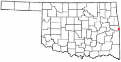
Location of Moffett, Oklahoma
|
|
| Country | United States |
| State | Oklahoma |
| County | Sequoyah |
| Area | |
| • Total | 1.00 sq mi (2.58 km2) |
| • Land | 0.98 sq mi (2.54 km2) |
| • Water | 0.02 sq mi (0.04 km2) |
| Elevation | 417 ft (127 m) |
| Population
(2020)
|
|
| • Total | 38 |
| • Density | 38.78/sq mi (14.97/km2) |
| Time zone | UTC-6 (Central (CST)) |
| • Summer (DST) | UTC-5 (CDT) |
| ZIP code |
74946
|
| Area code(s) | 539/918 |
| FIPS code | 40-49000 |
| GNIS feature ID | 2413007 |
Moffett is a small town in Sequoyah County, Oklahoma, United States. It is part of the larger Fort Smith, Arkansas-Oklahoma Metropolitan Statistical Area. In 2010, 128 people lived there. By 2020, the population had decreased to 38 residents.
Contents
Moffett's Early History
After the American Civil War ended, some Cherokee people and formerly enslaved Cherokee freedmen made their homes near where Moffett is today. A post office, which helps send mail, was set up in 1908. It was named after Martha Moffett Payne. The town soon became an important place for farming, especially for growing cotton.
Growth and Challenges in Moffett
Moffett officially became a town in 1928. Its population grew to 340 people by 1930 and reached its highest point of 538 in 1940. Before and during World War II, the town had places like bars that attracted soldiers from nearby Fort Smith, Arkansas and Camp Chaffee. Because of this, the U.S. Army made Moffett "off limits" during the war. This ban stayed in place until the mid-1970s. After World War II, the town's population started to shrink. By 1960, there were 357 residents, and the number has continued to go down.
Moffett has also faced several damaging floods over the years. Some of the biggest floods happened in 1943, 1957, 1986, 1990, and 2019.
Financial Troubles in Moffett
In 2007, the town had serious financial problems. It filed for Chapter 9 bankruptcy, which is a legal way for towns to get help when they can't pay their debts. This happened after Oklahoma's attorney general said the town was using a "speed trap." This meant the local police were giving out too many speeding tickets to drivers on U.S. Highway 64. The state stopped the town's police from giving out these tickets. Without the money from these tickets, Moffett could not pay back about $200,000 in debts left by a former mayor.
Moffett's Location and Area
Moffett is located in the flat area near the Arkansas River. It sits right across the river from Fort Smith, Arkansas.
The United States Census Bureau reports that the town covers a total area of about 0.1 square miles (0.26 square kilometers). All of this area is land.
Moffett's Population and People
| Historical population | |||
|---|---|---|---|
| Census | Pop. | %± | |
| 1930 | 340 | — | |
| 1940 | 538 | 58.2% | |
| 1950 | 380 | −29.4% | |
| 1960 | 357 | −6.1% | |
| 1970 | 312 | −12.6% | |
| 1980 | 269 | −13.8% | |
| 1990 | 219 | −18.6% | |
| 2000 | 179 | −18.3% | |
| 2010 | 128 | −28.5% | |
| 2020 | 38 | −70.3% | |
| U.S. Decennial Census | |||
In 2000, there were 179 people living in Moffett. These people lived in 61 households, with 40 of them being families. The town is home to people of various backgrounds, including White, African American, and Native American residents, as well as those of mixed heritage and Hispanic or Latino backgrounds.
Many households in Moffett had children under 18 living with them. There were different types of families and individuals living in the town. The population included a mix of young people, adults, and older residents.
Fun Facts About Moffett
Country music artist Charlie Walker released a song called Moffett, Oklahoma. It was part of his 1967 album Don't Squeeze My Sharmon.
See also
 In Spanish: Moffett (Oklahoma) para niños

