Alfalfa, Alabama facts for kids
Quick facts for kids
Alfalfa, Alabama
|
|
|---|---|
| Country | United States |
| State | Alabama |
| County | Marengo |
| Elevation | 144 ft (44 m) |
| Time zone | UTC-6 (Central (CST)) |
| • Summer (DST) | UTC-5 (CDT) |
| Area code(s) | 334 |
Alfalfa was once a small place in Marengo County, Alabama, United States. It was known as an unincorporated community. This means it was a settlement that didn't have its own local government. Instead, it was managed by the county.
Over time, Alfalfa became part of the nearby city of Demopolis. This process is called annexation. It means one area officially joins another, usually larger, area. Alfalfa used to have its own post office, but it is no longer open.
Where is Alfalfa Located?
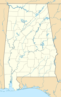
Alfalfa is found in the state of Alabama. It is located at coordinates 32°30′37″N 87°45′52″W / 32.51041°N 87.76445°W. The land there is about 144 feet (44 m) above sea level. This means it's not very high up.
Population and History
Alfalfa was never counted as a separate town in the U.S. Census. The U.S. Census is a count of all people in the country. It happens every ten years. From 1850 to 2010, Alfalfa's population was not listed on its own. This is because it was an unincorporated community. Since then, it has become part of Demopolis.
See also
 In Spanish: Alfalfa (Alabama) para niños


