
Alibori Department facts for kids
Quick facts for kids
Alibori
|
|
|---|---|

Map highlighting the Alibori Department
|
|
| Country | |
| Capital | Kandi |
| Area | |
| • Total | 25,683 km2 (9,916 sq mi) |
| Population
(2006)
|
|
| • Total | 595,196 |
| • Density | 23.1747/km2 (60.0222/sq mi) |
| Time zone | UTC+1 (WAT) |
Alibori is the largest and northernmost département (which is like a big region or state) in the country of Benin. It covers a huge area of about 25,683 square kilometers. In 2006, around 595,196 people lived there.
Contents
Exploring Alibori: A Region in Benin
Alibori is a fascinating part of Benin, known for its size and location. It shares borders with three other countries: Burkina Faso, Niger, and Nigeria. This makes it an important place for trade and travel in the region.
How Alibori is Organized
The département of Alibori is divided into 6 smaller areas called communes. Each commune has a main town at its center. These towns are:
- Banikoara
- Gogounou
- Kandi
- Karimama
- Malanville
- Ségbana

The History of Alibori
Alibori was created in 1999. Before that, it was part of another larger region called Borgou. Since 2008, the city of Kandi has been the capital of Alibori. This means Kandi is where the main government offices for the département are located.
Images for kids
-
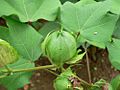
Cotton plants cultivated near Kandi

See also
 In Spanish: Departamento de Alibori para niños
