Alino Island facts for kids

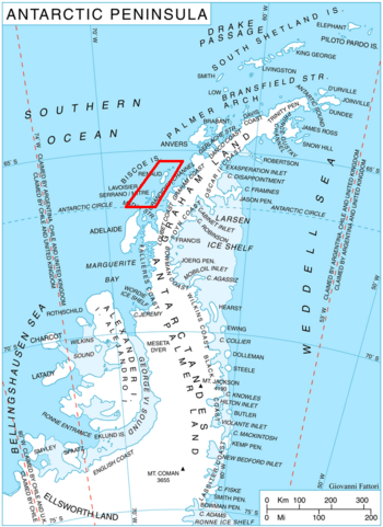
Location of Biscoe Islands in the Antarctic Peninsula region
|
|
|
Location in Antarctica
|
|
| Geography | |
|---|---|
| Location | Antarctica |
| Coordinates | 65°32′32″S 65°37′28″W / 65.54222°S 65.62444°W |
| Archipelago | Biscoe Islands |
| Administration | |
| Administered under the Antarctic Treaty System | |
| Demographics | |
| Population | Uninhabited |
Alino Island (which is ostrov Alino in Bulgarian) is a small island in Antarctica. It is mostly covered in ice and snow. This island is part of a group of islands called the Biscoe Islands.
Alino Island is about 1.2 kilometers (or 0.75 miles) long. It stretches from the southwest to the northeast. At its widest point, it is about 580 meters (or 0.36 miles) across. No people live on Alino Island.
Where is Alino Island?
Alino Island is located in the icy continent of Antarctica. It is found at coordinates 65°32′32″S 65°37′28″W / 65.54222°S 65.62444°W.
The island lies about 1 kilometer (or 0.6 miles) south-southeast of a place called Tula Point, which is on Renaud Island. British explorers mapped this area in 1971.
How Did Alino Island Get its Name?
Alino Island was named after a settlement in Western Bulgaria. This is a way to honor places and people from different parts of the world, even in faraway Antarctica.


