Amata Airport facts for kids
Quick facts for kids
Amata
|
|||||||||||
|---|---|---|---|---|---|---|---|---|---|---|---|
| Summary | |||||||||||
| Owner | Amata Community Inc. | ||||||||||
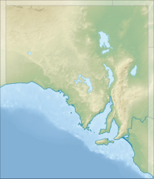
| Location | Amata, South Australia | ||||||||||
| Time zone | ACST (UTC+09:30) | ||||||||||
| • Summer (DST) | ACDT (UTC+10:30) | ||||||||||
| Elevation AMSL | 2,172 ft / 662 m | ||||||||||
| Coordinates | 26°5.8′S 131°12.2′E / 26.0967°S 131.2033°E | ||||||||||
| Map | |||||||||||
| Runway | |||||||||||
|
|||||||||||
Amata Airport is a small airport that serves the town of Amata. This town is located in the northern part of South Australia. It's part of a special area known as the APY Lands.
Amata Airport has a runway that is "sealed," meaning it's paved, like a road. This makes it one of only three sealed airstrips in the APY Lands. There are also six other airstrips in the area that are "unsealed," meaning they have dirt or gravel runways.
This airport is important because it has lights. These lights allow planes to land and take off safely even when it's dark outside. In 2016, the airport got an upgrade. A special fence was built around it to keep wild camels from walking onto the runway. This helps keep everyone safe!
See also
Black History Month on Kiddle
Famous African-American Artists:
 | Delilah Pierce |
 | Gordon Parks |
 | Augusta Savage |
 | Charles Ethan Porter |

All content from Kiddle encyclopedia articles (including the article images and facts) can be freely used under Attribution-ShareAlike license, unless stated otherwise. Cite this article:
Amata Airport Facts for Kids. Kiddle Encyclopedia.

