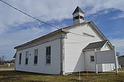
Andersonville, Indiana facts for kids
Quick facts for kids
Andersonville, Indiana
|
|
|---|---|

Andersonville Christian Church
|
|
| Country | |
| State | |
| County | Franklin County |
| Township | Posey Township |
| Elevation | 318 m (1,043 ft) |
| ZIP code |
47024
|
| GNIS feature ID | 2830375 |
Andersonville is a small, unincorporated community in Franklin County, Indiana, United States. It is located in the northwest part of the county, within Posey Township. An unincorporated community means it's a settlement that isn't part of an official city or town government.
Contents
The Story of Andersonville
How Andersonville Began
The history of Andersonville started a long time ago. On October 17, 1820, the government gave 160 acres of land to John and Simeon Barber. This land would later become the site of Andersonville.
From Ceylon to Andersonville
The original town was first known as Ceylon. Simeon Barber officially planned it in October 1831. It had 78 lots for homes and businesses. The streets were laid out 66 feet wide.
Later, in 1837, Joel (Joseph) Anderson and Fletcher Tevis added more lots and streets. This new part was called the Anderson Addition. An official post office was also set up, named Anderson P.O.
In 1849, the two parts of the town merged. It was then renamed Andersonville. The new name honored Thomas Anderson, who owned a local tavern. By 1915, Andersonville was home to about 350 people.
Where is Andersonville?
Andersonville is located at an elevation of about 1,050 feet above sea level. It sits right where two important roads meet. These roads are U.S. Route 52 and the east end of Indiana State Road 244. This intersection forms a sharp corner, and the town's streets run north and south within this triangle shape.
 | Leon Lynch |
 | Milton P. Webster |
 | Ferdinand Smith |


