Angourie, New South Wales facts for kids
Quick facts for kids AngourieNew South Wales |
|
|---|---|

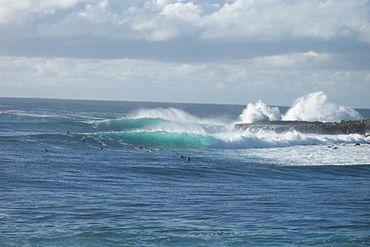
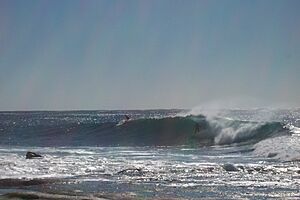
Angourie pumping
|
|
| Population | 222 (2016 census) |
| Postcode(s) | 2464 |
| LGA(s) | Clarence Valley |
| State electorate(s) | Clarence |
| Federal Division(s) | Page |
Angourie is a small coastal village in New South Wales, Australia. It is part of the Clarence Valley Council area. Angourie is located about 5 kilometers south of the town of Yamba. It sits right at the northern edge of the beautiful Yuraygir National Park. Nearby towns include Yamba and Wooloweyah.
Contents
Discover Angourie: A Coastal Gem
Angourie is famous for its stunning natural beauty and exciting outdoor activities. It's a popular spot for both locals and visitors. The village offers a mix of ocean adventures and peaceful nature experiences.
Surfing at Angourie Beach
Angourie Beach is a very special place for surfers. In 2007, it was named a National Surfing Reserve. This means it's recognized as an important spot for surfing in Australia. It was only the second place in the country to get this honor!
Many top surfers from around the world come here. They love the amazing waves at Angourie Point. This spot is known globally for its perfect surfing conditions. Just north of Angourie Point, you'll find "Spookies." These are short, powerful waves that are great for experienced surfers.
The Unique Angourie Pools
One of Angourie's most interesting attractions is the Angourie Pools. These are a group of freshwater pools with beautiful blue and green colors. They were formed a long time ago when people were quarrying (digging for stone) in the area. The miners accidentally hit underground springs, and water filled the quarries overnight!
The pools are very deep, about 15 to 20 meters. They are located less than 20 meters from the ocean. Mounds of rock and earth separate the pools from the sea. The Angourie Pools are a favorite spot for swimming and cooling off.
Exploring Yuraygir National Park
Angourie is right next to Yuraygir National Park. This park is known for having one of the most amazing coastal walking trails in New South Wales. You can explore stunning beaches, rocky headlands, and beautiful forests. It's a great place for hiking, birdwatching, and enjoying nature.
Gallery
 | Emma Amos |
 | Edward Mitchell Bannister |
 | Larry D. Alexander |
 | Ernie Barnes |


