Arenas del Rey facts for kids
Quick facts for kids
Arenas del Rey
|
|||
|---|---|---|---|
|
|||

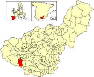
Location of Arenas del Rey
|
|||
| Country | Spain | ||
| Autonomous community | Andalusia | ||
| Province | Granada | ||
| Comarca | Comarca de Alhama | ||
| Area | |||
| • Total | 116 km2 (45 sq mi) | ||
| Elevation | 874 m (2,867 ft) | ||
| Population
(2018)
|
|||
| • Total | 1,178 | ||
| • Density | 10.16/km2 (26.30/sq mi) | ||
| Time zone | UTC+1 (CET) | ||
| • Summer (DST) | UTC+2 (CEST) | ||
Arenas del Rey is a small village located in the province of Granada, Spain. In 2018, about 1,178 people lived there.
This village is found just north of the beautiful Sierras of Tejeda, Almijara and Alhama Natural Park. This park is a great place to explore nature.
The Great Earthquake of 1884
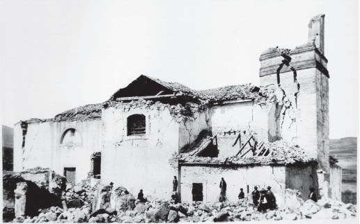
Arenas del Rey is known for a very big event in its history. It was the village most affected by a strong earthquake. This earthquake happened on December 25, 1884.
Impact on the Village
The earthquake caused a lot of damage. Almost 90% of the houses in Arenas del Rey collapsed. The remaining houses were also badly damaged. The entire village looked like a pile of broken buildings.
The local church and all other public buildings were destroyed. Sadly, 135 people lost their lives. Another 253 people were injured. After the earthquake, heavy snowfall made things even harder. This snow caused more deaths for over a week.
See also
 In Spanish: Arenas del Rey para niños
 | Mary Eliza Mahoney |
 | Susie King Taylor |
 | Ida Gray |
 | Eliza Ann Grier |


