
Argun (Caucasus) facts for kids
Quick facts for kids Argun, Orga, Chantiy-Argun |
|
|---|---|

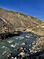
Shatili valley, Georgia
|
|


Location of mouth in Russia
|
|
| Countries | Georgia and Russia |
| Region | Mtskheta-Mtianeti |
| Federal subject | Chechnya |
| Physical characteristics | |
| Main source | 2,474 m (8,117 ft) |
| River mouth | Sunzha 69 m (226 ft) 43°21′12″N 45°56′56″E / 43.3532°N 45.9490°E |
| Length | 148 km (92 mi) |
| Basin features | |
| Progression | Sunzha→ Terek→ Caspian Sea |
| Basin size | 3,390 km2 (1,310 sq mi) |
The Argun River (also called Orga or Chantiy-Argun) is an important river in the Caucasus region. It flows through Georgia and the Chechen Republic in Russia. The Argun River is a branch of the Sunzha River, which then flows into the Terek River.
This river is about 148 kilometres (92 mi) (92 miles) long. Its basin, which is the area of land that drains into the river, covers about 3,390 square kilometres (1,310 sq mi) (1,309 sq mi). The Argun River starts high up in the northern Caucasus mountains in a place called Khevsureti, Georgia. It then flows through the western parts of Chechnya, including the Itum-Kalinsky and Shatoysky Districts.
The Argun River valley is a very special place for the Chechens. It's believed to be where they first settled. You can still see many old ruins of villages built in their traditional style. The river also acts as a natural border between the Shalinsky and Groznensky Districts. The city of Argun is named after this river.
On September 7, 2008, the only bridge crossing the Argun River in a key area collapsed. Luckily, drivers on the bridge were able to escape safely. Officials said that heavy military vehicles might have caused the accident.

Contents
What is the Argun River like?
The Argun River is 148 kilometres (92 mi) (92 miles) long. Its basin, the area of land that collects water for the river, is 3,390 square kilometres (1,310 sq mi) (1,309 sq mi). The river drops about 17.63 meters for every kilometer it flows. On average, it carries about 45.6 cubic meters of water per second.
Where does the Argun River start?
The Argun River begins high up in the mountains. Its water comes from glaciers on the northern slopes of the Greater Caucasus Range. In its upper part, before it joins with the Sharoargun River, it's known as Chanty-Argun.
How does the Argun River flow?
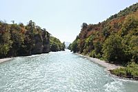
The river then flows through a deep cut in the mountains called the Argun Gorge. Near its source, the gorge has few trees. But further downstream, it's covered in thick forests. The mountainous area around the Argun River is home to the Itum-Kalinsky and Shatoisky districts.
This mountain region is where the Chechen people first lived. You can still see many old villages there. These villages often have traditional tower structures that are very old.
Where does the Argun River end?
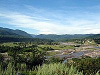
When the Argun River reaches the flat plains, it forms a natural border. It separates the Grozny and Shali regions of Chechnya. Finally, it flows into the Sunzha River. The valley near the plains is very populated. Before recent conflicts, it had many private homes and farms. The city of Argun is located near the lower part of the river.
Gallery
-
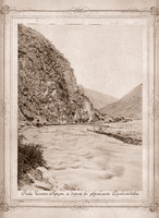
Chanty-Argun river. 1850-1896
-
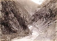
The Argun River (above Shatili), photo by Desha Moritz. 1897
-
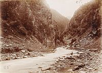
The Argun River, photo of the expedition of Count Desha Moritz. 1897
-
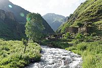
Shatili Valley
-
Argun near the village of Ushkaloy 2021
-
View of the Argun River (Shali district) in relative proximity to the village of Chiri-Yurt
-
Argun river in Duba-Yurt, Chechnya
-
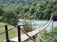
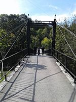
Suspension bridge near Duba-Yurt
-
Bridge across Argun to Nikhaloevsky waterfalls

._(%D1%84%D0%B0%D0%B9%D0%BB_2).jpg)
.jpg)


See also
 In Spanish: Río Argun (Cáucaso) para niños
