Arkdale, Wisconsin facts for kids
Quick facts for kids
Arkdale, Wisconsin
|
|
|---|---|

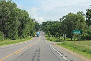
Wis-21 runs through town
|
|

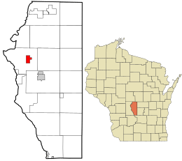
Location in Adams County and the state of Wisconsin.
|
|
| Country | United States |
| State | Wisconsin |
| County | Adams |
| Town | Strongs Prairie |
| Area | |
| • Total | 2.22 sq mi (5.75 km2) |
| • Land | 2.15 sq mi (5.56 km2) |
| • Water | 0.07 sq mi (0.20 km2) |
| Elevation | 935 ft (285 m) |
| Population
(2020)
|
|
| • Total | 201 |
| • Density | 90.5/sq mi (34.96/km2) |
| Time zone | UTC-6 (Central (CST)) |
| • Summer (DST) | UTC-5 (CDT) |
| Area code(s) | 608 |
| GNIS feature ID | 1560396 |
Arkdale is a small community in Adams County, Wisconsin, United States. It is not a city or town with its own government. Instead, it is part of the larger area called Strongs Prairie.
Arkdale is known as a census-designated place. This means the United States Census Bureau counts the people living there for official records. As of the 2020 Census, 201 people lived in Arkdale.
About Arkdale
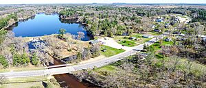
Arkdale covers an area of about 2.22 square miles (5.75 square kilometers). Most of this area is land, with a small part being water. The community is located in the beautiful state of Wisconsin.
Population Changes
The number of people living in Arkdale has grown over time.
- In 2010, the population was 158 people.
- By 2020, the population had increased to 201 people.
This shows that more people are choosing to live in this quiet Wisconsin community.
See also
 In Spanish: Arkdale (Wisconsin) para niños


