Arteaga, Coahuila facts for kids
Quick facts for kids
Arteaga
|
|
|---|---|

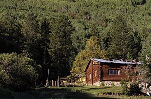
Cabin in Arteaga, Coahuila.
|
|
| Country | |
| State | Coahuila |
| Municipality | Arteaga |
| Founded | 31 October 1591 (Francisco de Urdiñola) |
| Elevation | 1,680 m (5,510 ft) |
| Population
(2000)
|
|
| • Total | 6,042 |
| Time zone | UTC-6 (Central (US Central)) |
| • Summer (DST) | UTC-5 (Central) |
| Postal code |
25350
|
Arteaga (pronounced ar-teh-AH-gah) is a charming city in the Mexican state of Coahuila. It's known as a "Pueblo Mágico," which means "Magical Town." These towns are special places in Mexico that offer visitors a unique experience. This is often because of their natural beauty, rich history, or cultural traditions. Arteaga is also the main town for the area around it, called the Arteaga municipality.
Contents
Exploring Arteaga's Location
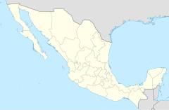
Arteaga is located in the beautiful state of Coahuila, Mexico. It is about 14 kilometers (9 miles) east of Saltillo, which is the state capital. You can find Arteaga along Federal Highways 57 and 54.
Arteaga's Size and People
The Arteaga municipality covers a large area of about 1,818 square kilometers (702 square miles). In 1995, about 18,907 people lived there. Besides the main city of Arteaga, the municipality also includes several smaller towns. Some of these are San Antonio de las Alazanas, El Tunal, San Juan de los Dolores, Huachichil, Los Lirios, Mesa de Tablas, Bella Unión, Escobedo, and Jamé.
Arteaga's Perfect Weather
People who live in Arteaga often say their town has the "most perfect" climate in North America. They boast about a comfortable average temperature of 22°C (72°F) all year round. This makes Arteaga a pleasant place to visit or live, no matter the season.
A Look Back in Time: Arteaga's History
The area where Arteaga is today was first settled in 1580. The first settlers came from Tlaxcala and named the place San Isidro de las Palomas.
Renaming the Town
On December 29, 1866, the town was renamed Arteaga. This was done to honor General José María Arteaga Magallanes. He was an important national hero from the 1800s. He also served as the governor of the state of Querétaro de Arteaga.
The Story of Landeros
Arteaga also includes a community called Landeros. This place was named after an American soldier of Irish background. He settled there after the army marched through the area in the 1840s.
See also
 In Spanish: Arteaga (Coahuila) para niños
 | Anna J. Cooper |
 | Mary McLeod Bethune |
 | Lillie Mae Bradford |


