
Coahuila facts for kids
Quick facts for kids
State of Coahuila
|
|||
|---|---|---|---|
|
|||

Location within Mexico
|
|||
| Country | |||
| Capital | Saltillo | ||
| Municipalities | 38 | ||
| Largest City | Saltillo | ||
| Area
Ranked 3rd |
|||
| • Total | 149,982 km2 (57,908 sq mi) | ||
| Population
(2005)
|
|||
| • Total | 2,495,200 (Ranked 17th) | ||
| Time zone | UTC-6 (CST) | ||
| • Summer (DST) | UTC-5 (CDT) | ||
| HDI (2004) | 0.8284 - high Ranked 3rd |
||
| ISO 3166-2 | MX-COA | ||
| Postal abbr. | Coah. | ||
| Website | Coahuila State Government | ||


Coahuila, officially known as the Free and Sovereign State of Coahuila de Zaragoza, is one of the 31 states in Mexico. Along with Mexico City, these make up the 32 main parts of the country.
Coahuila shares borders with other Mexican states. To the east, it borders Nuevo León. To the south, you'll find Zacatecas and San Luis Potosí. On its west side are Durango and Chihuahua.
To the north, Coahuila has a long border with the United States. This border stretches for about 512 kilometers (318 miles). It runs along the Rio Grande river, next to the U.S. state of Texas.
Coahuila is a very large state, covering about 151,563 square kilometers (58,519 sq mi). This makes it the third-largest state in Mexico. It is divided into 38 smaller areas called municipalities. In 2010, about 2,748,391 people lived in Coahuila.
The five biggest cities in Coahuila are:
- Saltillo, which is the state capital.
- Torreón, the second largest city.
- Monclova, which used to be the state capital.
- Ciudad Acuña.
- Piedras Negras.
History of Coahuila
The name Coahuila comes from old native words used in the region. It has been spelled in different ways, like Cuagüila and Cuauila. Some historians think the name means "flying serpent." Others believe it means "place of many trees" or "place where snakes crawl."
The state's full official name is Coahuila de Zaragoza. This name honors General Ignacio Zaragoza, a famous Mexican hero.
Images for kids
-
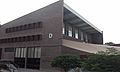
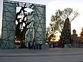
A building at the Iberoamerican University in Torreón.
-
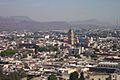
Saltillo, the capital city of Coahuila.
-
The city of Ciudad Acuña.
-
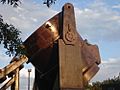
A monument celebrating Monclova's industries.
-
La Gran Plaza in Piedras Negras.
-
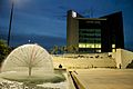
Plaza Mayor in Torreón.

.jpg)


.JPG)

See also
 In Spanish: Coahuila de Zaragoza para niños
