Ashboro, Indiana facts for kids
Quick facts for kids
Ashboro
|
|
|---|---|
| Country | United States |
| State | Indiana |
| County | Clay |
| Township | Sugar Ridge |
| Elevation | 610 ft (190 m) |
| ZIP code |
47840
|
| FIPS code | 18-02332 |
| GNIS feature ID | 449615 |
Ashboro is a small community located in Clay County, Indiana, in the United States. It's part of Sugar Ridge Township. Ashboro is known as an unincorporated community. This means it's a place where people live, but it doesn't have its own local government like a city or town. Instead, it's managed by the larger county. Ashboro is also considered part of the Terre Haute area.
History of Ashboro
Ashboro was started a long time ago, in the year 1858. It got its name from another place called Asheboro, North Carolina in North Carolina.
Early Post Office
When Ashboro was founded, a post office was opened there in 1858. A post office is where people send and receive mail. This post office helped the community for many years. It stayed open until 1918, when it was closed down. Interestingly, in its very early days, the post office was officially spelled "Ashborough."
Geography of Ashboro
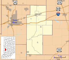
Ashboro is located in the state of Indiana. You can find its exact spot on a map using these geographic coordinates: 39°23′56″N 87°06′21″W / 39.39889°N 87.10583°W. These numbers tell you its precise latitude and longitude, like an address for a specific point on Earth.


