Asherville, Indiana facts for kids
Quick facts for kids
Asherville
|
|
|---|---|
| Country | United States |
| State | Indiana |
| County | Clay |
| Township | Jackson |
| Elevation | 659 ft (201 m) |
| ZIP code |
47834
|
| FIPS code | 18-02368 |
| GNIS feature ID | 447632 |
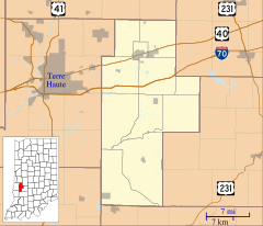
Asherville is a small, unincorporated community located in Jackson Township, Clay County, Indiana. Being "unincorporated" means it does not have its own local government. It is part of the larger Terre Haute Metropolitan Statistical Area.
History of Asherville
Asherville was first established in 1873. A person named John Asher was responsible for planning and setting up the community. In the same year, a post office was built in Asherville. This post office served the community for many years. However, it eventually closed down in 1912.
Geography of Asherville
Asherville is located in the state of Indiana. Its exact location can be found using geographic coordinates. These coordinates are 39°28′29″N 87°03′44″W / 39.47472°N 87.06222°W. This means it is at 39 degrees, 28 minutes, 29 seconds North latitude and 87 degrees, 3 minutes, 44 seconds West longitude.
 | Jewel Prestage |
 | Ella Baker |
 | Fannie Lou Hamer |


