Assé-le-Boisne facts for kids
Quick facts for kids
Assé-le-Boisne
|
|
|---|---|

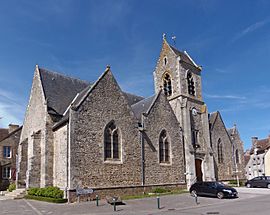
The church of Notre-Dame
|
|
| Country | France |
| Region | Pays de la Loire |
| Department | Sarthe |
| Arrondissement | Mamers |
| Canton | Sillé-le-Guillaume |
| Intercommunality | CC Haute Sarthe Alpes Mancelles |
| Area
1
|
28.39 km2 (10.96 sq mi) |
| Population
(Jan. 2019)
|
906 |
| • Density | 31.913/km2 (82.65/sq mi) |
| Demonym(s) | Asséboliens ou Asséens |
| Time zone | UTC+01:00 (CET) |
| • Summer (DST) | UTC+02:00 (CEST) |
| INSEE/Postal code |
72011 /72130
|
| Elevation | 69–213 m (226–699 ft) |
| 1 French Land Register data, which excludes lakes, ponds, glaciers > 1 km2 (0.386 sq mi or 247 acres) and river estuaries. | |
Assé-le-Boisne is a small town, also known as a commune, located in the western part of France. It is found in the region called Pays de la Loire, within the Sarthe department.
Contents
About Assé-le-Boisne
Assé-le-Boisne is a charming commune in France. It is known for its quiet, rural setting. The area is perfect for exploring the French countryside.
Where is Assé-le-Boisne?
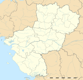
This commune is in the Sarthe department. The Sarthe department is part of the Pays de la Loire region. This region is in the western part of France. Assé-le-Boisne is located near the city of Mamers.
How Many People Live There?
As of January 2019, about 906 people live in Assé-le-Boisne. People who live here are sometimes called Asséboliens or Asséens. The population count helps us understand the size of the community.
Who Runs Assé-le-Boisne?
A mayor leads the commune of Assé-le-Boisne. From 2014 to 2020, the mayor was Jean-Louis Breton. The mayor helps manage the town and its services. The commune also works with other nearby towns. This is called intercommunality. Assé-le-Boisne is part of the Communauté de communes Haute Sarthe Alpes Mancelles. This group helps towns work together on projects.
What is the Area Like?
Assé-le-Boisne covers an area of about 28.39 square kilometers. This is roughly 10.96 square miles. The land here has different heights. The lowest point is 69 meters (226 feet) above sea level. The highest point is 213 meters (699 feet) above sea level. This shows that the area has some hills and valleys.
See also
 In Spanish: Assé-le-Boisne para niños


