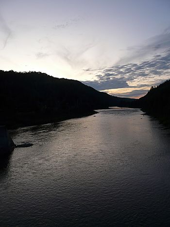
Assemetquagan River facts for kids
Quick facts for kids Assemetquagan River |
|
|---|---|
 |
|
| Native name | Rivière Matapédia |
| Country | Canada |
| Province | Quebec |
| Physical characteristics | |
| River mouth | Matapedia River 48°04′45″N 67°05′52″W / 48.07917°N 67.09778°W |
| Length | 50 km (31 mi) |
| Basin features | |
| Tributaries |
|
The Assemetquagan River is a freshwater river located in Quebec, Canada. It flows through the beautiful Matapedia Valley. This river starts high up in the Notre Dame Mountains. It then travels about 50 kilometres (31 mi) before joining the Matapedia River. This meeting point is about 20 kilometres (12 mi) northwest of Matapédia, Quebec.
The river is an important part of the natural landscape in the Gaspésie region. It flows through two main areas:
- The Avignon Regional County Municipality, which includes the unorganized territory of New River.
- The La Matapedia Regional County Municipality, which includes the unorganized territory of Routhierville, Quebec.
Where the River Flows
The Assemetquagan River begins in the mountainous Chic-Choc Mountains. These mountains are part of the larger Notre Dame Mountains range. The river's source is where two smaller rivers meet: the East Assemetquagan River and the West Assemetquagan River. These two rivers drain water from the northern mountains in an area called the Zec Casault.
This meeting point of the two smaller rivers is located in a place called Fauvel (township). From there, the Assemetquagan River flows for about 55.4 kilometres (34.4 mi).
The River's Journey
The river's path is quite winding. For much of its length, the Assemetquagan River forms the southern border of the Zec Casault. This is a protected area.
The river flows through different landscapes. It passes through deep valleys and collects water from many smaller streams. Some of these streams include McDavid stream, Lavoie stream, and Purvis Creek. It also flows past Beaver Creek, Hollow Creek, and Saint-Étienne Brook. Near its end, it collects water from Eight Miles Creek and Doiron stream.
Finally, the Assemetquagan River reaches its end. It flows into the Matapedia River. This confluence is about 15.7 kilometres (9.8 mi) northeast of the main meeting point of the Matapedia River.
What's in a Name?
The name "Assemetquagan" comes from the Mi'kmaq language. The Mi'kmaq are an Indigenous people of northeastern North America. The name roughly means "sudden waterway on a curve." This name perfectly describes how the river flows and bends.
The name "Assemetquagan River" was officially recognized on December 5, 1968. This was done by the Commission de toponymie du Québec, which is the official body in Quebec that names places.
 | Shirley Ann Jackson |
 | Garett Morgan |
 | J. Ernest Wilkins Jr. |
 | Elijah McCoy |

