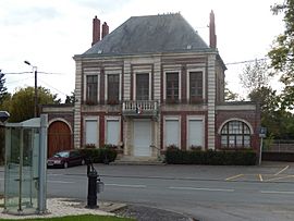
Athies, Somme facts for kids
Quick facts for kids
Athies
|
||
|---|---|---|
 |
||
|
||
| Country | France | |
| Region | Hauts-de-France | |
| Department | Somme | |
| Arrondissement | Péronne | |
| Canton | Ham | |
| Area
1
|
10.67 km2 (4.12 sq mi) | |
| Population
(2006)
|
660 | |
| • Density | 61.9/km2 (160.2/sq mi) | |
| Time zone | UTC+01:00 (CET) | |
| • Summer (DST) | UTC+02:00 (CEST) | |
| INSEE/Postal code |
80034 /80200
|
|
| Elevation | 47–88 m (154–289 ft) (avg. 78 m or 256 ft) |
|
| 1 French Land Register data, which excludes lakes, ponds, glaciers > 1 km2 (0.386 sq mi or 247 acres) and river estuaries. | ||
Athies is a small place in northern France. It is called a commune. A commune is like a local town or village area.
Athies is located in the Somme department. A department is a bit like a county or a region. The Somme department is part of a larger area called Hauts-de-France.
In 2006, about 660 people lived in Athies. This number helps us understand the size of the community.
What is a Commune?
A commune is the smallest type of local government area in France. It is run by a mayor and a local council. They help manage things like schools and roads.
Where is Athies?
Athies is in the Péronne arrondissement. An arrondissement is a part of a department. It helps organize local services. Athies is also in the Ham canton. A canton is a smaller area used for elections.
Geography of Athies
Athies covers an area of about 10.67 square kilometers. This is roughly 4.1 square miles. The land in Athies is mostly flat. Its elevation ranges from 47 to 88 meters above sea level. The average height is 78 meters.
See also
 In Spanish: Athies (Somme) para niños
 | Bessie Coleman |
 | Spann Watson |
 | Jill E. Brown |
 | Sherman W. White |


