
Atwood, Pennsylvania facts for kids
Quick facts for kids
Atwood, Pennsylvania
|
|
|---|---|
|
Borough
|
|
.jpg)
McLean Farm, a Pennsylvania Century Farm in Atwood
|
|

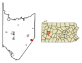
Location of Atwood in Armstrong County, Pennsylvania.
|
|

Atwood, Pennsylvania
Location in Pennsylvania
|
|
| Country | United States |
| State | Pennsylvania |
| County | Armstrong |
| Settled | 1860 |
| Incorporated | 1884 |
| Government | |
| • Type | Council-Mayor |
| Area | |
| • Total | 2.11 sq mi (5.47 km2) |
| • Land | 2.09 sq mi (5.42 km2) |
| • Water | 0.02 sq mi (0.05 km2) |
| Population
(2020)
|
|
| • Total | 112 |
| • Density | 53.54/sq mi (20.67/km2) |
| Time zone | UTC-5 (Eastern (EST)) |
| • Summer (DST) | UTC-4 (EDT) |
| FIPS code | 42-03480 |
Atwood is a small town, also known as a borough, located in Armstrong County, Pennsylvania, in the United States. It's a quiet place with a small population. In 2020, about 112 people lived there.
Contents
Where is Atwood Located?
Atwood is found in the eastern part of Armstrong County. Its exact location is 40°44′58″N 79°15′51″W / 40.74944°N 79.26417°W.
Roads and Waterways
A main road, Pennsylvania Route 210, goes right through Atwood. This road connects Atwood to other nearby towns. For example, it leads about 6 miles (10 km) southwest to Elderton and 6 miles (10 km) northeast to Plumville.
Near the northwestern edge of Atwood, you'll find Keystone Lake. This lake is a reservoir, which means it's a place where water is collected and stored. It's part of the North Branch Plum Creek.
How Big is Atwood?
The United States Census Bureau tells us that Atwood covers a total area of about 2.1 square miles (5.5 square kilometers). Most of this area, about 2.09 square miles (5.4 square kilometers), is land. A very small part, about 0.02 square miles (0.05 square kilometers), is water.
Who Lives in Atwood?
Let's look at how the number of people living in Atwood has changed over the years.
| Historical population | |||
|---|---|---|---|
| Census | Pop. | %± | |
| 1880 | 149 | — | |
| 1890 | 185 | 24.2% | |
| 1900 | 153 | −17.3% | |
| 1910 | 191 | 24.8% | |
| 1920 | 168 | −12.0% | |
| 1930 | 135 | −19.6% | |
| 1940 | 129 | −4.4% | |
| 1950 | 110 | −14.7% | |
| 1960 | 131 | 19.1% | |
| 1970 | 123 | −6.1% | |
| 1980 | 107 | −13.0% | |
| 1990 | 128 | 19.6% | |
| 2000 | 112 | −12.5% | |
| 2010 | 107 | −4.5% | |
| 2020 | 112 | 4.7% | |
| Sources: | |||
People and Families
Based on the 2000 census, there were 112 people living in Atwood. These people made up 42 households, and 34 of those were families.
Most people in Atwood are White, making up about 96.43% of the population. About 3.57% of the people were from other backgrounds. This also included people who identified as Hispanic or Latino.
Many households (38.1%) had children under 18 living with them. A large number (69.0%) were married couples. About 9.5% of households had a female head without a husband. About 19.0% of households were single individuals. Some people (7.1%) lived alone and were 65 or older.
The average household in Atwood had about 2.67 people. The average family had about 3.06 people.
Age and Income
The average age of people in Atwood in 2000 was 39 years old. This was just a bit younger than the average age for the whole county.
Here's a breakdown of ages:
- 25.0% were under 18 years old.
- 7.1% were between 18 and 24 years old.
- 34.8% were between 25 and 44 years old.
- 20.5% were between 45 and 64 years old.
- 12.5% were 65 years or older.
In terms of money, the average income for a household in Atwood was $28,750 per year. For families, the average income was $29,750. Men generally earned more than women. The average income per person in the borough was $12,026.
Some families (18.2%) and individuals (10.6%) lived below the poverty line. This included 8.3% of those under 18.
Cemetery
- Atwood Cemetery
Images for kids
-
Location of Atwood in Armstrong County, Pennsylvania.
See also
 In Spanish: Atwood (Pensilvania) para niños
