Auburndale (town), Wisconsin facts for kids
Quick facts for kids
Auburndale
|
|
|---|---|
|
Town
|
|

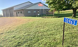
Auburndale Town Hall
|
|
| Country | |
| State | |
| County | Wood |
| Area | |
| • Total | 32.2 sq mi (83.5 km2) |
| • Land | 32.2 sq mi (83.5 km2) |
| Population
(2000)
|
|
| • Total | 829 |
| • Density | 25.714/sq mi (9.928/km2) |
| Time zone | UTC-6 (Central (CST)) |
| • Summer (DST) | UTC-5 (CDT) |
| Area codes | 715 & 534 |
| PLSS township | T25N R4E |
Auburndale is a small town located in Wood County, Wisconsin, in the United States. In the year 2000, about 829 people lived here. The smaller Village of Auburndale is also found within this town.
Contents
Where is Auburndale Located?
Auburndale is shaped almost like a square. It stretches about six miles from north to south and 5.75 miles from east to west. The total area of the town is about 32.2 square miles (or 83.5 square kilometers). All of this area is land, meaning there are no large lakes or rivers within its borders.
How Auburndale Started
The land that became Auburndale was first measured and mapped in the summer of 1851. This was done by a team working for the U.S. government. They were surveying the area to create official maps.
Early Land Surveys
In late 1852, another team came to mark the exact corners of each section of land. They walked through thick woods and waded across streams. They used special tools like a Gunter's chain (a long measuring chain) and a Solar compass (a compass that uses the sun to find directions).
After their work, the main surveyor wrote a description of the area. He said there were no swamps. He noted that the land was mostly covered with thick forests of trees like Hemlock, Sugar Maple, Yellow Birch, and Rock Elm. He also mentioned that White Pine trees were common near Mill Creek and parts of the Little O'Plane River.
Describing the Land
The surveyor described the land as mostly flat. About half of it had good soil for farming. Mill Creek flowed through the southwest part of the area, and a branch of the Little O'Plane River started there. Both were fast-moving streams, but their banks were too low to build watermills. He also noticed that compasses didn't always work perfectly in the area, especially near the center. At that time, there were no buildings or farms in the township.
The Town of Auburndale was officially created in 1874. It was named after the nearby Village of Auburndale.
Who Lives in Auburndale?
According to the 2000 census, 829 people lived in Auburndale. These people lived in 299 different homes, and 235 of these were families. On average, there were about 25.7 people living in each square mile.
Community Life
Many homes in Auburndale had children under 18 living there. Most households were married couples living together. The average household had about 2.77 people, and families had about 3.16 people.
Age Groups in Town
The people in Auburndale were spread across different age groups. About 26.4% of the population was under 18 years old. Around 32.2% were young adults between 25 and 44. About 14.1% of the residents were 65 years old or older. The average age of people in Auburndale was 36 years.
See also
 In Spanish: Auburndale (condado de Wood, Wisconsin) para niños


