Wood County, Wisconsin facts for kids
Quick facts for kids
Wood County
|
|
|---|---|
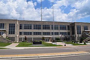
Wood County Courthouse
|
|
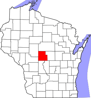
Location within the U.S. state of Wisconsin
|
|
 Wisconsin's location within the U.S. |
|
| Country | |
| State | |
| Founded | 1856 |
| Named for | Joseph Wood |
| Seat | Wisconsin Rapids |
| Largest city | Marshfield |
| Area | |
| • Total | 809 sq mi (2,100 km2) |
| • Land | 793 sq mi (2,050 km2) |
| • Water | 16 sq mi (40 km2) 2.0%% |
| Population
(2020)
|
|
| • Total | 74,207 |
| • Estimate
(2023)
|
73,939 |
| • Density | 93.6/sq mi (36.1/km2) |
| Time zone | UTC−6 (Central) |
| • Summer (DST) | UTC−5 (CDT) |
| Congressional districts | 3rd, 7th |
Wood County is a place in Wisconsin, a state in the United States. It's a type of local government area called a county. In 2020, about 74,207 people lived there.
The main city and where the county government is located is Wisconsin Rapids. The county is named after Joseph Wood, who was a politician in Wisconsin.
Contents
Exploring Wood County's Geography
Wood County covers about 809 square miles (2,095 square kilometers). Most of this is land, with a small part being water. The very center of Wisconsin is actually found in Wood County, about nine miles southeast of Marshfield.
Landscapes of Wood County
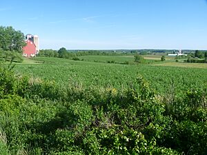
Wood County has two main types of landscapes. The northern part of the county is in the Northern Highlands. Here, you'll find rich farmland with heavy clay soil. Farmers grow crops like corn, soybeans, and hay, and raise dairy cows.
In the northwest, there's a special ridge of land called the Marshfield moraine. This ridge stretches through Marshfield, Bakerville, and Nasonville.
The southern and central areas, from Babcock to Wisconsin Rapids, are part of the Central Plain. This area is flat and marshy. It's one of the biggest places in the United States for growing cranberries.
The Wisconsin River flows through the southeast part of the county. This river has sand flats, islands, and curved sections called oxbows. The river drops about 120 feet as it goes through the county, which helps power several dams. Other smaller streams and rivers also drain the county, with a few isolated hills like Powers Bluff.
How Glaciers Shaped the Land
The flat, sandy southern part of Wood County was formed by the last ice age. Even though the ice didn't reach Wood County, it came very close. The ice blocked the Wisconsin River, creating a huge, cold lake called Glacial Lake Wisconsin. This lake covered much of the southern county.
When the glacier melted about 13,000 years ago, the lake drained. Rivers then cut new paths through the sand that had settled at the bottom of the lake. Later, during a dry period, wind blew the sand into large dunes. One dune in the town of Saratoga is eight meters thick. Over time, the area became wet again, and peat (decayed plant matter) formed on top of the sand.
Early explorers in 1852 described the area around Cranmoor as a huge marsh, like a "Wisconsin Everglades." They noted deep water and many small islands with lots of cranberries.
The northern part of the county was shaped by even older glaciers. These glaciers left behind glacial till, which is the basis for the heavy soil found there. The Marshfield moraine in the northwest is likely from these older glaciers. Its smooth surface shows it has been eroding for a very long time.
Underground Rock Formations
Most of Wood County, except for the northeast, sits on top of a layer of Cambrian sandstone. This sandstone formed long before the last ice age. While much of it has worn away or is buried, you can still see it in gravel pits and some bluffs. The Lindsey bluffs and Birch Bluff are examples of hard sandstone that resisted erosion.
Powers Bluff is different. It's much older, with a hard center of Precambrian quartzite and a peak of chert. A marker there says it's a "worn down peak of an ancient mountain range."
Neighboring Counties
Wood County shares its borders with several other counties:
- Marathon County to the north
- Portage County to the east
- Adams County to the southeast
- Juneau County to the south
- Jackson County to the southwest
- Clark County to the northwest
Wildlife Protection Areas
- Mead Wildlife Area is a place where wildlife is protected.
Understanding Wood County's Population
The number of people living in Wood County has changed over time. Here's a look at the population from 1860 to 2020:
| Historical population | |||
|---|---|---|---|
| Census | Pop. | %± | |
| 1860 | 2,425 | — | |
| 1870 | 3,912 | 61.3% | |
| 1880 | 8,981 | 129.6% | |
| 1890 | 18,127 | 101.8% | |
| 1900 | 25,865 | 42.7% | |
| 1910 | 30,583 | 18.2% | |
| 1920 | 34,643 | 13.3% | |
| 1930 | 37,865 | 9.3% | |
| 1940 | 44,465 | 17.4% | |
| 1950 | 50,500 | 13.6% | |
| 1960 | 59,105 | 17.0% | |
| 1970 | 65,362 | 10.6% | |
| 1980 | 72,799 | 11.4% | |
| 1990 | 73,605 | 1.1% | |
| 2000 | 75,555 | 2.6% | |
| 2010 | 74,749 | −1.1% | |
| 2020 | 74,207 | −0.7% | |
| U.S. Decennial Census 1790–1960 1900–1990 1990–2000 2010 2020 |
|||
Population in 2020
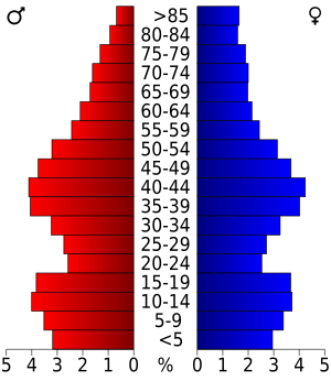
In 2020, the county had 74,207 people. This means there were about 93.6 people for every square mile. Most people in the county were White (91.4%). There were also smaller groups of Asian, Native American, and Black or African American people. About 3.2% of the population identified as Hispanic or Latino.
Getting Around Wood County: Transportation
Wood County has several ways to travel, including major highways, railroads, and airports.
Main Roads
Many important highways run through Wood County, helping people travel across the area and to other parts of Wisconsin.
Railways
- The Canadian National railway also operates in the county.
Airports
- KMFI - Marshfield Municipal Airport
- KISW - South Wood County Airport
Communities in Wood County
Wood County is home to several cities, villages, towns, and smaller communities.
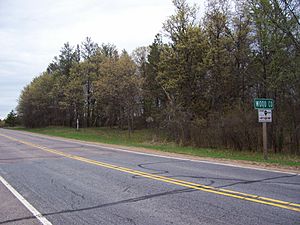
Cities in Wood County
- Marshfield (partly in Marathon County)
- Nekoosa
- Pittsville
- Wisconsin Rapids (the county seat)
Villages in Wood County
- Arpin
- Auburndale
- Biron
- Hewitt
- Milladore (partly in Portage County)
- Port Edwards
- Rudolph
- Vesper
Towns in Wood County
Census-Designated Places
These are areas that are like towns but are not officially incorporated as cities or villages.
Unincorporated Communities
These are smaller communities that are not officially part of a city, village, or town.
- Altdorf
- Bakerville
- Bethel
- Blenker
- Cranmoor
- Dexterville
- Eight Corners
- Kellner (partial)
- Lindsey
- Nasonville
- Sherry
- Veedum
- Walker
See also
 In Spanish: Condado de Wood (Wisconsin) para niños
 | Victor J. Glover |
 | Yvonne Cagle |
 | Jeanette Epps |
 | Bernard A. Harris Jr. |


