Marathon County, Wisconsin facts for kids
Quick facts for kids
Marathon County
|
|
|---|---|
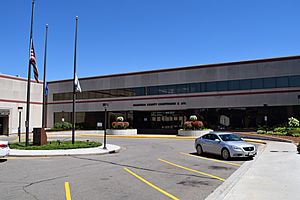
Marathon County Courthouse in Wausau
|
|
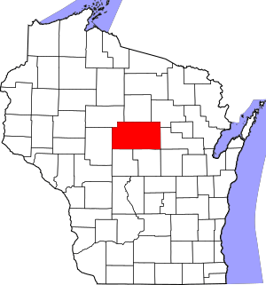
Location within the U.S. state of Wisconsin
|
|
 Wisconsin's location within the U.S. |
|
| Country | |
| State | |
| Founded | 1850 |
| Named for | Marathon, Greece |
| Seat | Wausau |
| Largest city | Wausau |
| Area | |
| • Total | 1,576 sq mi (4,080 km2) |
| • Land | 1,545 sq mi (4,000 km2) |
| • Water | 31 sq mi (80 km2) 2.0%% |
| Population
(2020)
|
|
| • Total | 138,013 |
| • Estimate
(2023)
|
138,612 |
| • Density | 89.3/sq mi (34.5/km2) |
| Time zone | UTC−6 (Central) |
| • Summer (DST) | UTC−5 (CDT) |
| Congressional district | 7th |
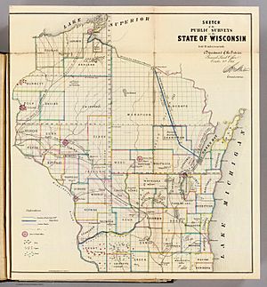
Marathon County is a county located in the state of Wisconsin, USA. In 2020, about 138,013 people lived here. The main city and county seat is Wausau. Marathon County was started in 1850. It was created from a part of Portage County. Back then, it reached all the way to the northern border with Michigan. The county is named after a famous battlefield in Marathon, Greece.
The Wausau area, including Marathon County, is an important part of Wisconsin.
Contents
Exploring Marathon County's Geography
Marathon County covers a total area of about 1,576 square miles. Most of this area, 1,545 square miles, is land. The rest, about 31 square miles, is water. This makes it the largest county in Wisconsin by land area. It is also the fourth-largest by total area.
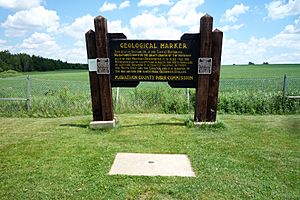
A special spot in Marathon County is near Rietbrock. Here, you can find a marker that shows the exact center of the northern half of the Western Hemisphere. This spot is at 45°N latitude and 90°W longitude. It means it's halfway from the Equator to the North Pole. It is also a quarter of the way around the world from the Prime Meridian.
Major Roads and Transportation
Many important roads pass through Marathon County. These include major highways that help people travel across the state.
Key Highways
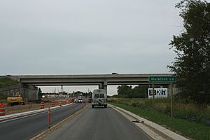
 Interstate 39
 US Highway 51
 Wisconsin Highway 13
 Wisconsin Highway 29
 Wisconsin Highway 34
 Wisconsin Highway 49
 Wisconsin Highway 52
 Wisconsin Highway 97
 Wisconsin Highway 98
 Wisconsin Highway 107
 Wisconsin Highway 153
Rail and Air Travel
Trains also move goods through the county. The main railway companies are Canadian National and Watco. For local travel, Metro Ride offers bus services. If you need to fly, there are two airports:
- KAUW - Wausau Downtown Airport
- KCWA - Central Wisconsin Airport
Neighboring Counties
Marathon County shares its borders with several other counties:
- Lincoln County to the north
- Langlade County to the northeast
- Shawano County to the east
- Waupaca County to the southeast
- Portage County to the south
- Wood County to the south
- Clark County to the west
- Taylor County to the northwest
Natural Areas
The Mead Wildlife Area is a special place in Marathon County. It is a protected area for wildlife. Here, you can observe many different animals and plants in their natural home.
Population and People
In 2020, the population of Marathon County was 138,013 people. This means there were about 89 people living in each square mile. The county is home to a diverse group of people. Most residents are White (86.9%). Other groups include Asian (6.2%), Black or African American (0.9%), and Native American (0.5%). About 3.2% of the population identifies as Hispanic or Latino.
Libraries for Learning
The main library for Marathon County is the Marathon County Public Library (MCPL). Its headquarters are in downtown Wausau, Wisconsin. There are also eight smaller branch libraries. These are located in towns like Athens, Edgar, and Mosinee. These libraries offer books, computers, and programs for everyone.
Fun and Recreation
Marathon County offers many ways to have fun outdoors.
County Parks to Explore
There are many parks managed by the county. These parks are great places for outdoor activities.
- Amco County Park
- Big Eau Pleine County Park
- Big Rapids County Park
- Bluegill Bay County Park
- Cherokee County Park
- Courthouse Square
- D.C. Everest County Park
- Dells of the Eau Claire County Park
- Duane L. Corbin Shooting Range Park
- Library Park
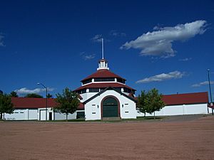
- Marathon Park
- Mission Lake County Park
- Mountain-Bay State Park Trail
- Reitbrock Geographical Marker
- Rib Falls County Park
- Sunny Vale County Park
Snowmobile Adventures
During winter, Marathon County is a popular spot for snowmobiling. There are over 884 miles of trails. Local snowmobile clubs help keep these trails in great condition.
Communities in Marathon County
Marathon County has many cities, villages, and towns.
Cities in the County
- Abbotsford (mostly in Clark County)
- Colby (mostly in Clark County)
- Marshfield (mostly in Wood County)
- Mosinee
- Schofield
- Wausau (the county seat)
Villages to Visit
- Athens
- Birnamwood (mostly in Shawano County)
- Dorchester (mostly in Clark County)
- Edgar
- Elderon
- Fenwood
- Hatley
- Kronenwetter
- Maine
- Marathon City
- Rib Mountain
- Rothschild
- Spencer
- Stratford
- Unity (partly in Clark County)
- Weston
Towns in the Area
- Bergen
- Berlin
- Bern
- Bevent
- Brighton
- Cassel
- Cleveland
- Day
- Easton
- Eau Pleine
- Elderon
- Emmet
- Frankfort
- Franzen
- Green Valley
- Guenther
- Halsey
- Hamburg
- Harrison
- Hewitt
- Holton
- Hull
- Johnson
- Knowlton
- Marathon
- McMillan
- Mosinee
- Norrie
- Plover
- Reid
- Rib Falls
- Rietbrock
- Ringle
- Spencer
- Stettin
- Texas
- Wausau
- Weston
- Wien
Other Communities
- Knowlton (Census-designated place)
- Rib Mountain (Census-designated place)
Many smaller, unincorporated communities are also part of Marathon County. These include places like Ashley, Dancy, and Milan. Some old communities, like Callon, are now considered ghost towns.
Learning and Education
Marathon County has many school districts. These districts help educate students from kindergarten through high school. Some of the school districts include:
- Abbotsford School District
- Antigo School District
- Athens School District
- Auburndale School District
- Colby School District
- D.C. Everest Area School District
- Edgar School District
- Marathon City School District
- Marshfield School District
- Medford Area School District
- Merrill Area School District
- Mosinee School District
- Rosholt School District
- Spencer School District
- Stratford School District
- Wausau School District
- Wittenberg-Birnamwood School District
See also
 In Spanish: Condado de Marathon para niños
 | Delilah Pierce |
 | Gordon Parks |
 | Augusta Savage |
 | Charles Ethan Porter |


