McMillan, Wisconsin facts for kids
Quick facts for kids
McMillan, Wisconsin
|
|
|---|---|

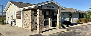
Town hall
|
|

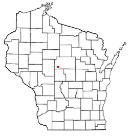
Location of McMillan, Wisconsin
|
|
| Country | |
| State | |
| County | Marathon |
| Area | |
| • Total | 34.4 sq mi (89.0 km2) |
| • Land | 34.1 sq mi (88.4 km2) |
| • Water | 0.2 sq mi (0.5 km2) |
| Elevation | 1,260 ft (384 m) |
| Population
(2010)
|
|
| • Total | 1,968 |
| • Density | 57.27/sq mi (22.112/km2) |
| Time zone | UTC-6 (Central (CST)) |
| • Summer (DST) | UTC-5 (CDT) |
| Area code(s) | 715 & 534 |
| FIPS code | 55-46975 |
| GNIS feature ID | 1583623 |
| PLSS township | T26N R3E |
McMillan is a town located in Marathon County, Wisconsin, in the United States. It is part of the larger Wausau area. In 2010, about 1,968 people lived here. The small community also called McMillan is found within the town. A part of the Mead Wildlife Area is also located here.
Contents
Geography of McMillan
The town of McMillan covers a total area of about 89 square kilometers (about 34 square miles). Most of this area, 88.4 square kilometers (34.1 square miles), is land. Only a small part, 0.5 square kilometers (0.2 square miles), is water.
History of McMillan
Early Land Surveys
The land that would become McMillan was first measured and mapped in 1851. This was done by a team working for the U.S. government. In 1853, another team marked the corners of each section of land. They walked through forests and waded through streams to do this. They used special tools like a chain and a compass.
After their work, the surveyor wrote a description of the land. He noted that the area had several swamps. He also said that much of the land was not very good, especially where hemlock and fir trees grew. He described the soil as poor, with many rocks on the surface. However, he mentioned that areas with hardwood trees had good soil, suitable for farming.
The surveyor also noted that the pine trees in the area were not of good quality and were spread out. He said the town had plenty of water from streams. One stream was big enough for mills, with high banks and rocky bottoms. At that time, there were no buildings or improvements in the area.
The Sawmill and Village
In 1874, two men named B.F. and Charles McMillan built a sawmill. It was located on the Little Eau Pleine River, about five miles north of the young town of Marshfield. The sawmill did very well, and many workers came to live nearby.
A school was started in 1881. The village of McMillan grew and even had its own post office. At one point, at least 200 people lived there. However, all the nearby timber was eventually cut down. In 1911, the sawmill had to close. Most of the village slowly disappeared. Today, only a neighborhood known as "Sugarbush" remains from the original village.
Farming and New Communities
After the timber was cut, settlers bought the land. They had to clear the tree stumps to create farms. These farms eventually focused on dairy, sending their milk to local cheese factories.
In the early 1900s, another small community formed. It was called Riverside, located where roads T and 97 cross the Little Eau Pleine River. Riverside had a saloon, a grocery store, a feed mill, a blacksmith, and a school. But like the village of McMillan, Riverside also faded away over time.
McMillan Marsh Wildlife Area
Some of the low-lying land on the west side of McMillan was not good for farming after the timber was gone. Not much was done with this land. It often caught fire about every ten years, and much of it became tax-delinquent.
Later, two people named Krasin and Hartle bought some of this land. They tried to start a fur farm there. In 1948, the county turned 37 sections of this land into a public hunting ground. This area stretches from west McMillan into the Town of Spencer along the Little Eau Pleine River. It has since become the McMillan Marsh Wildlife Area. Today, it is managed as part of the larger Mead Wildlife Area.
Population Information
In 2000, there were 1,790 people living in the town of McMillan. There were 611 households, and 521 of these were families. The population density was about 20 people per square kilometer (52 people per square mile).
About 45% of the households had children under 18 living with them. Most households, 78.2%, were married couples living together. The average household had about 2.93 people, and the average family had about 3.20 people.
Looking at ages, 30% of the population was under 18 years old. About 8% of the people were 65 years or older. The average age in the town was 39 years.
Notable People from McMillan
- Ben Lang: He was a farmer, a businessman, and a politician who lived in the town of McMillan. A politician is someone who works in government, making decisions for the community.
See also
 In Spanish: McMillan (Wisconsin) para niños
 | Janet Taylor Pickett |
 | Synthia Saint James |
 | Howardena Pindell |
 | Faith Ringgold |


