Wausau, Wisconsin facts for kids
Quick facts for kids
Wausau, Wisconsin
|
||
|---|---|---|
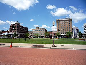
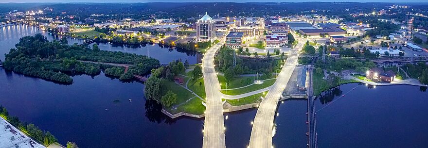
Downtown Wausau
|
||
|
||
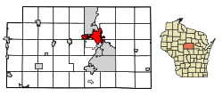
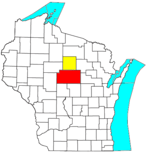
Location of Wausau in Marathon County, Wisconsin.
|
||
| County | Marathon | |
| Area | ||
| • City | 20.33 sq mi (52.66 km2) | |
| • Land | 19.22 sq mi (49.77 km2) | |
| • Water | 1.11 sq mi (2.88 km2) | |
| Elevation | 1,207 ft (368 m) | |
| Population
(2020)
|
||
| • City | 39,994 | |
| • Density | 2,081.1/sq mi (803.5/km2) | |
| • Metro | 134,063 | |
| Time zone | UTC−6 (Central) | |
| • Summer (DST) | UTC−5 (Central) | |
| ZIP Code |
54401 and 54403
|
|
| Area code(s) | 715 & 534 | |
| FIPS code | 55-84475 | |
Wausau (pronounced waw-saw) is a city in Wisconsin, USA. It is the main city of Marathon County and sits along the Wisconsin River. In 2020, about 39,994 people lived there. Wausau is the center of a larger area that includes all of Marathon County, with a population of 138,013 in 2020. Nearby towns like Schofield, Weston, and Rib Mountain are also part of the Wausau area.
Contents
History of Wausau
How Wausau Started
For thousands of years, different Native American tribes lived in this area. The Ojibwe people were here when Europeans first arrived. They traded furs with French settlers for many years. Later, British-American traders from the east took over the fur trade.
European-American settlers came to the area in the mid-1800s because of the Wisconsin River. They called the area "Big Bull Falls" because of the long, bubbly rapids in the river. In 1836, the Ojibwe people gave up much of their land here to the United States government. The name Wausau comes from the Ojibwe word “waasa,” which means "a faraway place."
In 1840, George Stevens started cutting down pine trees for lumber and built a sawmill. Lumber was the first big industry here. More sawmills quickly appeared along the river. By 1846, Walter McIndoe became a local leader. He helped create Marathon County in 1850.
Wausau became a town in 1852 and kept growing. Many German immigrants moved to the area after 1848. By 1861, Wausau was officially a village.
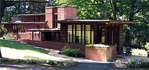
Churches, schools, and businesses grew. In 1872, Wausau became a city. August Kickbusch was elected its first mayor. He had brought 702 people from Germany to settle in Wausau. Kickbusch started a grocery business that his family continued. His home is now on the National Register of Historic Places.
When the railroad arrived in 1874, it was easier for people and businesses to come to Wausau. This helped the city find new industries as the lumber business started to slow down because many forests had been cut down. By 1906, most of the lumber was gone, but Wausau kept growing. Other nearby towns struggled when their lumber mills closed.
Wausau in the 1900s and Today
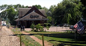
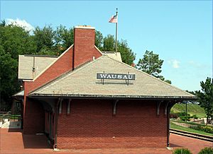
Wausau survived because of its good location on the Wisconsin River. Its economy became more diverse in the early 1900s. A big insurance company, Employers Insurance of Wausau (now part of Liberty Mutual), became very important. Their logo showed the downtown train station with the city skyline.
The Wall Street Crash of 1929 (a big economic downturn) affected Wausau. Many businesses had to lay off workers or close. But after World War II, Wausau modernized and continued to grow in business, education, and recreation.
In the late 1970s, Hmong refugees from Southeast Asia came to Wausau. Local churches helped them settle into American life.
In 1983, the Wausau Center shopping mall opened. In the late 1990s, the city created the 400 Block in downtown Wausau. This is an open, grassy area with sidewalks, which is now a popular spot for summer festivals. Wausau has continued to improve the downtown area. The Dudley tower, the tallest commercial building in Wisconsin outside of Milwaukee, is located in Wausau.
Geography and Climate
Where is Wausau?
Wausau is located at 44°57′N 89°38′W. The city covers about 20.33 square miles (52.66 km²), with most of it being land and a small part water. It sits about 1,195 feet (364 meters) above sea level.
Wausau is special because it's close to the exact center of the northern half of the Western Hemisphere. Just west of Wausau, the 45°N line (halfway between the equator and the North Pole) crosses the 90°W line (a quarter of the way around the world from the prime meridian).
Wausau's Weather
Wausau has a warm-summer humid continental climate. This means it has warm summers and cold, snowy winters. The area is like a "hemiboreal forest," which is a mix of northern forests (with lots of pine trees) and southern forests (with more trees that lose their leaves in fall).
| Climate data for Wausau Downtown Airport, Wisconsin (1991–2020 normals, extremes 1895–present) | |||||||||||||
|---|---|---|---|---|---|---|---|---|---|---|---|---|---|
| Month | Jan | Feb | Mar | Apr | May | Jun | Jul | Aug | Sep | Oct | Nov | Dec | Year |
| Record high °F (°C) | 54 (12) |
59 (15) |
80 (27) |
91 (33) |
104 (40) |
100 (38) |
107 (42) |
99 (37) |
99 (37) |
91 (33) |
75 (24) |
61 (16) |
107 (42) |
| Mean maximum °F (°C) | 41 (5) |
46 (8) |
61 (16) |
77 (25) |
85 (29) |
90 (32) |
90 (32) |
89 (32) |
85 (29) |
76 (24) |
60 (16) |
45 (7) |
93 (34) |
| Mean daily maximum °F (°C) | 22.8 (−5.1) |
27.4 (−2.6) |
39.6 (4.2) |
53.7 (12.1) |
67.1 (19.5) |
76.2 (24.6) |
80.3 (26.8) |
77.9 (25.5) |
69.8 (21.0) |
55.7 (13.2) |
40.4 (4.7) |
27.9 (−2.3) |
53.2 (11.8) |
| Daily mean °F (°C) | 14.8 (−9.6) |
18.5 (−7.5) |
30.1 (−1.1) |
43.1 (6.2) |
55.8 (13.2) |
65.4 (18.6) |
69.5 (20.8) |
67.4 (19.7) |
59.2 (15.1) |
46.3 (7.9) |
32.8 (0.4) |
20.7 (−6.3) |
43.6 (6.4) |
| Mean daily minimum °F (°C) | 6.7 (−14.1) |
9.5 (−12.5) |
20.6 (−6.3) |
32.4 (0.2) |
44.6 (7.0) |
54.5 (12.5) |
58.7 (14.8) |
56.9 (13.8) |
48.6 (9.2) |
37.0 (2.8) |
25.2 (−3.8) |
13.5 (−10.3) |
34.0 (1.1) |
| Mean minimum °F (°C) | −16 (−27) |
−12 (−24) |
−1 (−18) |
19 (−7) |
31 (−1) |
41 (5) |
49 (9) |
46 (8) |
34 (1) |
24 (−4) |
9 (−13) |
−8 (−22) |
−19 (−28) |
| Record low °F (°C) | −40 (−40) |
−40 (−40) |
−33 (−36) |
3 (−16) |
20 (−7) |
29 (−2) |
37 (3) |
32 (0) |
18 (−8) |
8 (−13) |
−15 (−26) |
−27 (−33) |
−40 (−40) |
| Average precipitation inches (mm) | 1.20 (30) |
1.08 (27) |
1.83 (46) |
3.12 (79) |
3.79 (96) |
4.67 (119) |
3.86 (98) |
4.07 (103) |
3.83 (97) |
3.07 (78) |
1.85 (47) |
1.54 (39) |
33.91 (861) |
| Average snowfall inches (cm) | 14.8 (38) |
12.7 (32) |
8.3 (21) |
6.5 (17) |
0.2 (0.51) |
0.0 (0.0) |
0.0 (0.0) |
0.0 (0.0) |
0.0 (0.0) |
0.9 (2.3) |
6.5 (17) |
14.4 (37) |
64.3 (163) |
| Average precipitation days (≥ 0.01 in) | 10.5 | 8.3 | 9.4 | 12.0 | 13.4 | 12.8 | 11.5 | 10.6 | 11.5 | 10.7 | 9.8 | 10.6 | 131.1 |
| Average snowy days (≥ 0.1 in) | 11.3 | 8.7 | 6.3 | 3.6 | 0.2 | 0.0 | 0.0 | 0.0 | 0.0 | 0.8 | 5.6 | 10.6 | 47.1 |
| Source: NOAA | |||||||||||||
People of Wausau
| Historical population | |||
|---|---|---|---|
| Census | Pop. | %± | |
| 1860 | 543 | — | |
| 1870 | 1,349 | 148.4% | |
| 1880 | 4,277 | 217.0% | |
| 1890 | 9,253 | 116.3% | |
| 1900 | 12,354 | 33.5% | |
| 1910 | 16,560 | 34.0% | |
| 1920 | 18,951 | 14.4% | |
| 1930 | 23,758 | 25.4% | |
| 1940 | 27,268 | 14.8% | |
| 1950 | 30,386 | 11.4% | |
| 1960 | 31,943 | 5.1% | |
| 1970 | 32,806 | 2.7% | |
| 1980 | 32,426 | −1.2% | |
| 1990 | 37,060 | 14.3% | |
| 2000 | 38,426 | 3.7% | |
| 2010 | 39,114 | 1.8% | |
| 2020 | 39,994 | 2.2% | |
| U.S. Decennial Census | |||
Wausau is the largest city in the Wausau–Merrill Combined Statistical Area. This area includes Marathon County and Lincoln County, and had a total population of 155,475 in 2000.
In 1996, a census estimate showed that Hmong people were the largest minority group in Wausau, making up about 11% of the population.
Population in 2020
In 2020, Wausau had 39,994 people. The city had about 2,081 people per square mile. Most residents (78.3%) were White. About 11.9% were Asian, 1.7% Black, and 0.7% Native American. About 4.1% of the population was Hispanic or Latino.
Hmong Community
The Hmong Americans are the largest ethnic minority group in Wausau. After the Vietnam War, churches and aid groups helped Hmong refugees settle in Wausau. In 1978, there were only a few dozen Hmong immigrants. By 1984, there were 800.
By 2022, the Hmong population was 3,885, making up over 80% of the city's Asian population. Many Hmong families own their homes, and more people are going to college. Their school test scores and graduation rates are also getting better.
Wausau's Economy
Almost one-third of Marathon County's economy comes from manufacturing (making things in factories). The rest comes from service industries. Important industries in Wausau include making paper, insurance, building homes, and tourism.
Wausau has a lower unemployment rate than average, meaning more people have jobs. The city continues to create new jobs and grow its economy in both manufacturing and services. Wausau also has many banks and credit unions.
The Wausau area is famous for growing American ginseng, a plant used in traditional medicine. It is also known for its red granite, which is mined nearby.
Arts and Culture
Wausau offers many fun events like Exhibitour, Concerts on the Square, Market Place Thursdays, and Screen on the Green. The city also celebrates the Hmong New Year.
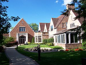
The Leigh Yawkey Woodson Art Museum is in Wausau. It has a famous "Birds in Art" collection and a collection of beautiful decorative glass.
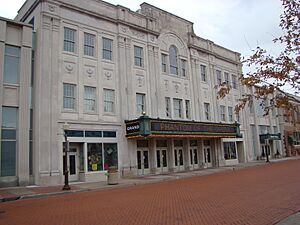
The Grand Theater in downtown Wausau hosts both local and national performances.
Sports in Wausau
- The Wausau Woodchucks baseball team plays at Athletic Park. They are part of the Northwoods League, a summer league for college baseball players. Their mascot is Woody Woodchuck.
- The Wausau River Hawks, another baseball team, also play at Athletic Park.
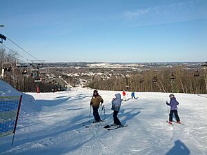
- Granite Peak Ski Area on nearby Rib Mountain offers downhill skiing. It's the highest skiable mountain in Wisconsin, with 74 runs and seven ski lifts. It first became a ski area in 1937.
- Wausau hosts the yearly Badger State Winter Games.
- The city has a kayak course on the Wisconsin River that has hosted many competitions.
- Nine Mile Recreation Area is a popular spot for running, skiing, and biking events. It hosts an annual 24-hour mountain biking race.
- Wausau is home to the Wausau Curling Club, which has an eight-sheet ice surface for curling. A new curling facility opened in 2013.
- In the summer, local softball teams play at the Sunnyvale Softball Complex, which has five softball fields and two volleyball courts.
- A new soccer complex is planned for Wausau, expected to open in 2014.
Parks and Outdoor Fun
Wausau has 37 city parks, covering 337 acres. These parks are managed by the Wausau and Marathon County Parks, Recreation, and Forestry Department.
- Oak Island Community Park and Fern Island Community Park are next to each other on the Wisconsin River. Oak Island has tennis courts, playgrounds, a baseball field, and shelters. A bridge connects it to Fern Island, which hosts music festivals.
- Athletic Park is a baseball stadium where the Wausau Woodchucks play.
- Whitewater Park has Class I-II+ rapids on the Wisconsin River in downtown Wausau. It's a great place for whitewater kayaking and canoeing.
- Sylvan Hills is a county park within Wausau. In winter, you can go tubing down its hills.
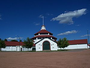
- Marathon Park is another county park in the city. It hosts the Wisconsin Valley Fair and has camping grounds, hockey rinks, a curling barn, playgrounds, and a miniature golf course. It also has a section of old-growth forest and the Little Red School House.
Education in Wausau
Schools for Kids
Wausau is served by the Wausau School District. It has 14 elementary schools, two middle schools (John Muir and Horace Mann), and two high schools (Wausau East and Wausau West). There are also two charter schools: Wausau Engineering and Global Leadership Academy (EGL) and Enrich Excel Achieve Learning Academy (EEA). EGL focuses on science, technology, engineering, and math. EEA is for students who prefer a different learning style than traditional schools.
The D.C. Everest Area School District also serves a large part of the Wausau area. It has 7 elementary schools, one middle school, one junior high, and one senior high.
There are also private schools in Wausau. The Roman Catholic schools are called Newman Catholic Schools, including elementary, middle, and high schools. Other private schools include Trinity Lutheran, Our Savior's Lutheran School, Faith Christian Academy, and a Seventh-day Adventist school.
Colleges and Universities
Wausau has several options for higher education:
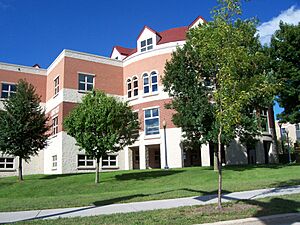
- University of Wisconsin–Stevens Point at Wausau: This is a two-year campus of the University of Wisconsin–Stevens Point.
- Northcentral Technical College: A two-year technical college.
- Satellite campuses of Lakeland University, Rasmussen University, and Medical College of Wisconsin.
Libraries
The Marathon County Public Library (MCPL) – Wausau Headquarters is the largest library in the Wausau area. It's located downtown. It's the main library for all public libraries in Marathon County. The Marathon County Historical Museum also has a library.
Media
- The Wausau Daily Herald is the local daily newspaper.
- Wausau Pilot and Review is a local online newspaper.
- City Pages is a free weekly newspaper.
Transportation
Airports
- AUW – Wausau Downtown Airport: This airport is for smaller planes, charter flights, and seaplanes.
- CWA – Central Wisconsin Airport: This airport has commercial flights from airlines like American Eagle and Delta Connection.
Buses
Metro Ride provides bus service within Wausau. For longer trips, Lamers Bus Lines offers daily trips to Milwaukee, and Coach USA/Van Galder has daily trips to Janesville and Madison.
Roads and Highways
Major roads in Wausau include Grand Avenue, North 6th Street, East and West Bridge Street, and Stewart Avenue.
The city's streets are set up with numbered "Streets" on the east side of the Wisconsin River and numbered "Avenues" on the west side.
| I-39 goes south towards Portage. | |
| U.S. 51 goes north to Woodruff, Wisconsin and south to Stevens Point. | |
| WIS 29 goes east to Green Bay and west to Abbotsford and Chippewa Falls. | |
| WIS 52 goes east to Antigo. |
Famous People from Wausau
- Chris Bangle: Former Chief of Design at BMW Auto Group.
- Elroy "Crazy Legs" Hirsch: Famous football player and member of the Pro Football Hall of Fame.
- Jalen Johnson: NBA player for the Atlanta Hawks.
- Dave Krieg: Former football player.
- Liberace: Famous pianist and entertainer (lived and worked in Wausau for a time).
- Marissa Mayer: Former CEO of Yahoo!.
- Jim Otto: Football player, member of the Pro Football Hall of Fame.
- Grace Stanke: Miss America 2023.
- Dean Witter: Businessman who founded the investment company Dean Witter & Company.
See also
 In Spanish: Wausau (Wisconsin) para niños
 | James Van Der Zee |
 | Alma Thomas |
 | Ellis Wilson |
 | Margaret Taylor-Burroughs |


