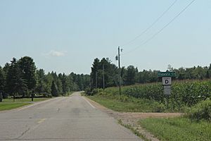
Shawano County, Wisconsin facts for kids
Quick facts for kids
Shawano County
|
|
|---|---|
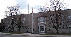
Shawano County Courthouse, built mid-1950s
|
|
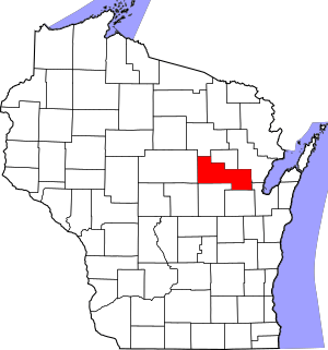
Location within the U.S. state of Wisconsin
|
|
 Wisconsin's location within the U.S. |
|
| Country | |
| State | |
| Founded | February 16, 1853 |
| Seat | Shawano |
| Largest city | Shawano |
| Area | |
| • Total | 909 sq mi (2,350 km2) |
| • Land | 893 sq mi (2,310 km2) |
| • Water | 16 sq mi (40 km2) 1.8%% |
| Population
(2020)
|
|
| • Total | 40,881 |
| • Estimate
(2023)
|
41,109 |
| • Density | 45.8/sq mi (17.7/km2) |
| Time zone | UTC−6 (Central) |
| • Summer (DST) | UTC−5 (CDT) |
| Congressional district | 8th |
Shawano County (pronounced SHAW-noh) is a county in the state of Wisconsin, United States. It was first called Shawanaw County. In 2020, about 40,881 people lived here. The main city and county seat is Shawano.
Shawano County is part of the Shawano, WI Micropolitan Statistical Area. This area is also included in the larger Green Bay–Shawano, WI Combined Statistical Area.
Contents
History of Shawano County
How Shawano County Got Its Name
The name "Shawano" comes from an Ojibwa word. It means "southern" because this area was the southern edge of the Ojibwa nation's land. Some people believe the county, city, and lake were named after a Menominee chief named Sawanoh. He led a group of people who lived in this area.
A historical marker from 1958 says the lake was named because it was the southern border of the Chippewa (Ojibwe) territory. Over time, the spelling of Shawano has changed. It was once written as Sawanoh, Shawanaw, Sharuno, and other ways. This shows how different languages like French, German, and English influenced how the name was written down.
Native American Communities in Shawano County
The Stockbridge-Munsee Community lives in Shawano County today. They are a group of Algonquian-speaking people. Their ancestors, the Mahican and Lenape tribes, traditionally lived along the Hudson River Valley in the East. Their reservation includes the towns of Bartelme and Red Springs.
Early Days of Shawano County
Shawano County was officially created in 1853. It was first known as Shawanaw County. The county kept this older spelling until 1864.
From the mid-1800s, many European Americans moved to the county. These included people from Germany and Poland. They started farms and helped the county grow. Before them, French-Canadian and British fur traders explored the area. They traded with the Chippewa and other Native American groups.
First European Settlers and Development
Samuel Farnsworth was one of the first non-Native Americans to explore the Shawano area. In 1843, he traveled up the Wolf River. He was looking for good places to cut down trees for lumber. When he arrived, a small Menominee village was there. The Native Americans were friendly and helpful. Farnsworth and his group then built a sawmill where the Shawano Lake Channel meets the Wolf River.
In 1844, Captain William Powell set up a trading post nearby. He had helped the government talk to Native Americans when treaties were signed. These treaties allowed white settlers to move into this part of Wisconsin.
In 1854, E. F. Sawyer planned a new village near Powell's trading post. But people preferred the area around the old mill. So, they voted to make Shawanaw the county seat.
Forming the County Government
Shawano County was officially organized in 1853. It was formed from parts of Oconto and Outagamie Counties. Only men could vote back then. Forty-seven votes were cast, and three supervisors were elected. At that time, there were 254 registered people living in the county.
The county's name was changed from Shawanaw to Shawano in 1864. The original name, Sha-wa-Nah-Pay-Sa, meant "lake to the south" in Menominee and Chippewa. When it was first formed, the county had three townships: Richmond, Waukechon, and Shawano. Later, 22 more townships were added, making a total of 25.
Education and Buildings
The first school in Shawano County was built in 1860. Orlin Andrews was the first teacher. By 1898, there were 108 public schools in the county. These schools had 124 teachers.
A courthouse was built on Main Street in 1857. It was replaced with a new one in 1879–80. The county board decided to build a new courthouse and jail in 1953.
People Who Settled Here
The first settlers in Shawano County came from places like New England, Canada, and British Columbia. Many people from Bohemia settled in the Leopolis area. Norwegians settled around Wittenberg, Lessor, Lunds, and Navarino. Germans were a very large group throughout the county. In 1900, 4,524 out of 27,475 people in the county were born in Germany.
Geography of Shawano County
Shawano County covers about 909 square miles (2,354 square kilometers). Most of this area, about 893 square miles (2,313 square kilometers), is land. The rest, about 16 square miles (41 square kilometers), is water.
Counties Nearby
- Menominee County - north
- Oconto County - east
- Brown County - southeast
- Outagamie County - south
- Waupaca County - south
- Portage County - southwest
- Marathon County - west
- Langlade County - northwest
Main Roads
 U.S. Highway 45
 Highway 22 (Wisconsin)
 Highway 29 (Wisconsin)
 Highway 32 (Wisconsin)
 Highway 47 (Wisconsin)
 Highway 52 (Wisconsin)
 Highway 55 (Wisconsin)
 Highway 110 (Wisconsin)
 Highway 117 (Wisconsin)
 Highway 153 (Wisconsin)
 Highway 156 (Wisconsin)
 Highway 160 (Wisconsin)
 Highway 187 (Wisconsin)
Railroads
- Watco
Airport
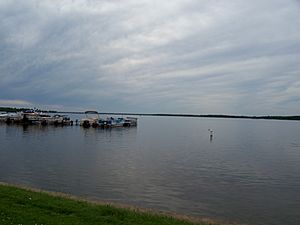
The city and county work together to run the Shawano Municipal Airport (KEZS). This airport is located on Shawano Lake.
Demographics of Shawano County
| Historical population | |||
|---|---|---|---|
| Census | Pop. | %± | |
| 1860 | 829 | — | |
| 1870 | 3,166 | 281.9% | |
| 1880 | 10,371 | 227.6% | |
| 1890 | 19,236 | 85.5% | |
| 1900 | 27,475 | 42.8% | |
| 1910 | 31,884 | 16.0% | |
| 1920 | 33,975 | 6.6% | |
| 1930 | 33,516 | −1.4% | |
| 1940 | 35,378 | 5.6% | |
| 1950 | 35,249 | −0.4% | |
| 1960 | 34,351 | −2.5% | |
| 1970 | 32,650 | −5.0% | |
| 1980 | 35,928 | 10.0% | |
| 1990 | 37,157 | 3.4% | |
| 2000 | 40,664 | 9.4% | |
| 2010 | 41,949 | 3.2% | |
| 2020 | 40,881 | −2.5% | |
| U.S. Decennial Census 1790–1960 1900–1990 1990–2000 2010 2020 |
|||
Population in 2020
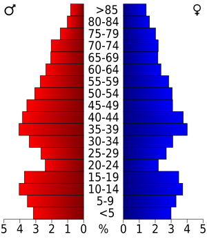
In 2020, the 2020 United States census counted 40,881 people living in Shawano County. There were 17,153 households and 11,265 families. The population density was about 45.8 people for every square mile. There were 20,354 housing units, with an average of 22.8 units per square mile.
The table below shows the different racial groups in Shawano County. The US Census counts Hispanic/Latino people as an ethnic group, separate from racial categories.
| Race | Pop 2010 | Pop 2020 | % 2010 | % 2020 |
|---|---|---|---|---|
| White (NH) | 36,951 | 34,404 | 88.09% | 84.16% |
| Black or African American (NH) | 131 | 117 | 0.31% | 0.29% |
| Native American or Alaska Native (NH) | 3,025 | 3,309 | 7.21% | 8.09% |
| Asian (NH) | 180 | 165 | 0.43% | 0.4% |
| Pacific Islander (NH) | 12 | 6 | 0.03% | 0.01% |
| Some other race (NH) | 8 | 59 | 0.02% | 0.14% |
| Mixed/multi-racial (NH) | 737 | 1,645 | 1.76% | 4.02% |
| Hispanic or Latino | 905 | 1,176 | 2.16% | 2.88% |
| Total | 41,949 | 40,881 |
In terms of race, the county was 84.8% White, 8.5% Native American, 0.4% Asian, and 0.3% Black or African American. About 1.2% were from other races, and 4.8% were from two or more races. About 2.9% of the population was Hispanic or Latino.
Communities in Shawano County
Cities
- Marion (mostly in Waupaca County)
- Shawano (county seat)
Villages
- Aniwa
- Birnamwood (partly in Marathon County)
- Bonduel
- Bowler
- Cecil
- Eland
- Gresham
- Mattoon
- Pulaski (mostly in Brown County and Oconto County)
- Tigerton
- Wittenberg
Towns
- Almon
- Angelica
- Aniwa
- Bartelme
- Belle Plaine
- Birnamwood
- Fairbanks
- Germania
- Grant
- Green Valley
- Hartland
- Herman
- Hutchins
- Lessor
- Maple Grove
- Morris
- Navarino
- Pella
- Red Springs
- Richmond
- Seneca
- Washington
- Waukechon
- Wescott
- Wittenberg
Census-designated places (CDPs)
- Angelica
- Caroline
- Green Valley
- Krakow
- Leopolis
- Middle Village (partial)
- Navarino
- Paac Ciinak
- Pella
- Pulcifer
- Thornton
- Tilleda
Unincorporated communities
- Adams Beach
- Advance
- Almon
- Belle Plaine
- Briarton
- Five Corners
- Frazer Corners
- Hofa Park
- Hunting
- Landstad
- Laney
- Lunds
- Lyndhurst
- Morgan
- Pittsfield (partial)
- Red River
- Regina
- Rose Lawn
- Shepley
- Slab City
- Split Rock
- Whitcomb
- Zachow
See also
 In Spanish: Condado de Shawano para niños
 | Georgia Louise Harris Brown |
 | Julian Abele |
 | Norma Merrick Sklarek |
 | William Sidney Pittman |


