Brown County, Wisconsin facts for kids
Quick facts for kids
Brown County
|
|
|---|---|
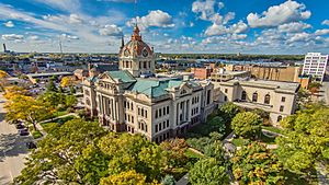
Brown County Courthouse in Green Bay
|
|
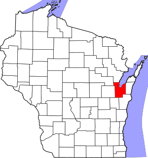
Location within the U.S. state of Wisconsin
|
|
 Wisconsin's location within the U.S. |
|
| Country | |
| State | |
| Founded | 1818 |
| Named for | Jacob Brown |
| Seat | Green Bay |
| Largest city | Green Bay |
| Area | |
| • Total | 616 sq mi (1,600 km2) |
| • Land | 530 sq mi (1,400 km2) |
| • Water | 86 sq mi (220 km2) 14% |
| Population
(2020)
|
|
| • Total | 268,740 |
| • Estimate
(2023)
|
271,417 |
| • Density | 436.3/sq mi (168.44/km2) |
| Time zone | UTC−6 (Central) |
| • Summer (DST) | UTC−5 (CDT) |
| Congressional district | 8th |
Brown County is a county located in the state of Wisconsin in the United States. It's like a special area within the state. As of 2020, about 268,740 people live here. This makes it the fourth-most populated county in Wisconsin.
The main city and government center of Brown County is Green Bay. Brown County is also part of the larger Green Bay city area.
Contents
History of Brown County
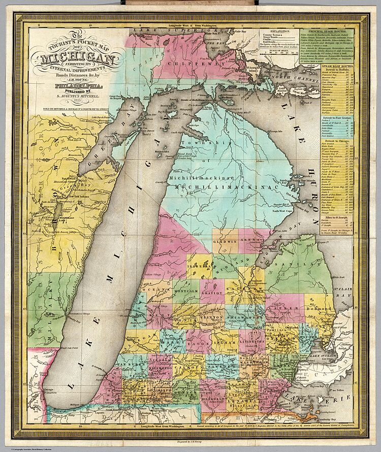
Brown County is one of the very first counties in Wisconsin. It was created way back in 1818 by the government of the Michigan Territory. Back then, it covered the entire eastern half of what is now Wisconsin!
The county was named after Major General Jacob Brown. He was an important military leader during the War of 1812.
In its early days, several towns along the Fox River wanted to be the county seat. The first county seat was in Menomoneeville in 1824. This area is now part of Allouez.
Later, in 1837, people voted to move the county seat to De Pere. But the location was voted on again in 1854. This time, Green Bay was chosen as the county seat, and it has been ever since.
Did you know Brown County is home to Wisconsin's oldest known tree? It's a cedar tree that is about 1,300 years old! You can find it growing on the Niagara Escarpment.
Geography and Nature
Brown County covers a total area of about 616 square miles. Most of this, about 530 square miles, is land. The remaining 86 square miles, which is about 14%, is water.
Main Roads
Many important roads run through Brown County. These roads help people travel and transport goods.
|
Trains and Buses
Trains also play a role in transportation here. Companies like Watco, Canadian National, and Escanaba and Lake Superior Railroad operate in the county. For local travel, Green Bay Metro provides bus services.
Population Facts
| Historical population | |||
|---|---|---|---|
| Census | Pop. | %± | |
| 1840 | 2,107 | — | |
| 1850 | 6,215 | 195.0% | |
| 1860 | 11,795 | 89.8% | |
| 1870 | 25,168 | 113.4% | |
| 1880 | 34,078 | 35.4% | |
| 1890 | 39,164 | 14.9% | |
| 1900 | 46,359 | 18.4% | |
| 1910 | 54,098 | 16.7% | |
| 1920 | 61,889 | 14.4% | |
| 1930 | 70,249 | 13.5% | |
| 1940 | 83,109 | 18.3% | |
| 1950 | 98,314 | 18.3% | |
| 1960 | 125,082 | 27.2% | |
| 1970 | 158,244 | 26.5% | |
| 1980 | 175,280 | 10.8% | |
| 1990 | 194,594 | 11.0% | |
| 2000 | 226,778 | 16.5% | |
| 2010 | 248,007 | 9.4% | |
| 2020 | 268,740 | 8.4% | |
| U.S. Decennial Census 1790–1960 1900–1990 1990–2000 2010–2020 |
|||
The population of Brown County has grown a lot over the years! In 1840, only 2,107 people lived here. By 2020, that number had jumped to 268,740.
In 2020, most people in Brown County were White (79.2%). There were also people of Asian, Black, and Native American backgrounds. About 9.8% of the population identified as Hispanic or Latino.
In 2010, there were 248,007 people living in Brown County. About 31% of households had children under 18. The average age of people living in the county was about 36.2 years old.
Communities in Brown County
Brown County has several different types of communities. These include cities, villages, and towns.
Cities
Villages
- Allouez
- Ashwaubenon
- Bellevue
- Denmark
- Hobart
- Howard (partly in Outagamie County)
- Pulaski (partly in Shawano County and Oconto County)
- Suamico
- Wrightstown (partly in Outagamie County)
Towns
Other Communities
- Census-designated places: These are areas that are like towns but not officially incorporated.
- Unincorporated communities: These are smaller places that don't have their own local government.
- Anston
- Askeaton
- Bay Settlement
- Benderville
- Buckman
- Champion
- Chapel Ridge
- Coppens Corner
- Edgewater Beach
- Fontenoy
- Glenmore
- Henrysville
- Hollandtown
- Humboldt
- Kolb
- Kunesh
- Langes Corners
- Lark
- Little Rapids
- Mill Center
- Morrison
- New Franken
- Pine Grove
- Pittsfield (partial)
- Poland
- Red Banks
- Shirley
- Sniderville (partial)
- Sugar Bush
- Wayside
- Wequiock
- Native American communities:
- Oneida Nation of Wisconsin (partial)
- Former communities: These places used to be separate towns or neighborhoods but are now part of other areas.
Neighboring Counties
Brown County shares borders with several other counties:
- Oconto County – to the north
- Door County – to the northeast (shares a water border in Green Bay)
- Kewaunee County – to the east
- Manitowoc County – to the southeast
- Calumet County – to the southwest
- Outagamie County – to the west
- Shawano County – to the northwest
Education
Brown County has many school districts that serve its communities. These districts help make sure kids get a good education.
- Ashwaubenon School District
- Brillion School District
- De Pere Unified School District
- Denmark School District
- Green Bay Area School District
- Howard-Suamico School District
- Kaukauna Area School District
- Luxemburg-Casco School District
- Pulaski Community School District
- Reedsville School District
- West De Pere School District
- Wrightstown Community School District
See also
 In Spanish: Condado de Brown (Wisconsin) para niños
 | Victor J. Glover |
 | Yvonne Cagle |
 | Jeanette Epps |
 | Bernard A. Harris Jr. |


