Outagamie County, Wisconsin facts for kids
Quick facts for kids
Outagamie County
|
|
|---|---|
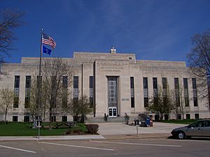
Outagamie County Administration Complex
|
|
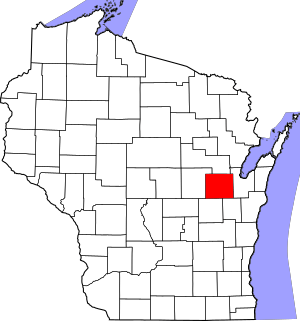
Location within the U.S. state of Wisconsin
|
|
 Wisconsin's location within the U.S. |
|
| Country | |
| State | |
| Founded | 1852 |
| Seat | Appleton |
| Largest city | Appleton |
| Area | |
| • Total | 645 sq mi (1,670 km2) |
| • Land | 638 sq mi (1,650 km2) |
| • Water | 7.1 sq mi (18 km2) 1.1%% |
| Population
(2020)
|
|
| • Total | 190,705 |
| • Estimate
(2023)
|
193,234 |
| • Density | 295.67/sq mi (114.16/km2) |
| Time zone | UTC−6 (Central) |
| • Summer (DST) | UTC−5 (CDT) |
| Congressional district | 8th |
Outagamie County is a county in the Fox Cities area of Wisconsin, a state in the United States. It is located in the northeast part of the state. In 2020, about 190,705 people lived there. The main city and county seat (where the county government is) is Appleton.
Outagamie County is part of a larger area called the Appleton, WI Metropolitan Statistical Area. This area also connects with Neenah and Oshkosh. The county was named after the historic Meskwaki (Fox) people.
Contents
History
The name "Outagamie" comes from a French word. It means "dwellers of other shore" or "dwellers on the other side of the stream." This name described the Meskwaki (Fox) people, who used to live along the St. Lawrence River and south of the Great Lakes. They lived in a large part of Wisconsin before European settlers arrived.
Outagamie County was officially created in 1851. It started working as a county in 1852. Before that, it was part of Brown County.
Geography
The U.S. Census Bureau says that Outagamie County covers a total area of 645 square miles. Most of this (638 square miles) is land, and a small part (7.1 square miles) is water.
Neighboring Counties
- Shawano County - to the north
- Brown County - to the east
- Calumet County - to the southeast
- Winnebago County - to the southwest
- Waupaca County - to the west
Rivers
- Wolf River: This river flows through New London and Shiocton in the western part of the county.
- Fox River: This river is in the southeastern corner of the county. It runs through Appleton and Kaukauna.
- Shioc River: This river joins the Wolf River in Shiocton.
- Embarrass River: This river also runs through New London and merges with the Wolf River there.
Lakes
- Black Otter Lake: This lake is in Hortonville. It's the only lake in the county and is popular for fishing.
Transportation
Main Highways
Railroads
- Canadian National
- Watco
Buses
- Valley Transit (Wisconsin)
Airports
- Appleton International Airport (KATW) serves Outagamie County and nearby towns. It is the third busiest airport in Wisconsin. Four airlines fly from here to 16 different places.
- Shiocton Airport (W34) is a smaller airport with a grass runway. It is located in Shiocton, Wisconsin.
Population Information
| Historical population | |||
|---|---|---|---|
| Census | Pop. | %± | |
| 1860 | 9,587 | — | |
| 1870 | 18,430 | 92.2% | |
| 1880 | 28,716 | 55.8% | |
| 1890 | 38,690 | 34.7% | |
| 1900 | 46,247 | 19.5% | |
| 1910 | 49,102 | 6.2% | |
| 1920 | 55,113 | 12.2% | |
| 1930 | 62,790 | 13.9% | |
| 1940 | 70,032 | 11.5% | |
| 1950 | 81,722 | 16.7% | |
| 1960 | 101,794 | 24.6% | |
| 1970 | 119,356 | 17.3% | |
| 1980 | 128,799 | 7.9% | |
| 1990 | 140,510 | 9.1% | |
| 2000 | 160,971 | 14.6% | |
| 2010 | 176,695 | 9.8% | |
| 2020 | 190,705 | 7.9% | |
| U.S. Decennial Census 1790–1960 1900–1990 1990–2000 2010 2020 |
|||
2020 Census Details
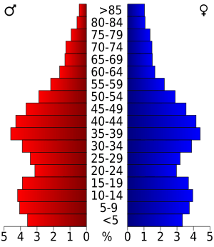
As of the 2020 census, the county's population was 190,705 people. This means there were about 299 people living in each square mile. There were 79,131 homes in the county.
Most people in the county (86.0%) were White. Other groups included Asian (3.5%), Native American (1.6%), and Black or African American (1.6%). About 4.9% of the population was Hispanic or Latino.
Communities
Cities
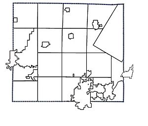
- Appleton (county seat; also partly in Calumet County and Winnebago County)
- Kaukauna (partially in Calumet County)
- New London (mostly in Waupaca County)
- Seymour
Villages
- Bear Creek
- Black Creek
- Combined Locks
- Greenville
- Harrison (mostly in Calumet County)
- Hortonville
- Howard (mostly in Brown County)
- Kimberly
- Little Chute
- Nichols
- Shiocton
- Wrightstown (mostly in Brown County)
Towns
Census-designated place
Unincorporated communities
Ghost towns/neighborhoods
Native American community
- Oneida Nation of Wisconsin (partial)
See also
 In Spanish: Condado de Outagamie para niños
 | DeHart Hubbard |
 | Wilma Rudolph |
 | Jesse Owens |
 | Jackie Joyner-Kersee |
 | Major Taylor |


