
Howard, Wisconsin facts for kids
Quick facts for kids
Howard, Wisconsin
|
|
|---|---|
 |
|
| Nickname(s):
Duck Creek
|
|
| Motto(s):
Rising to New Heights
|
|

Location of Howard in Brown County, Wisconsin.
|
|
| Country | |
| State | |
| Counties | Brown, Outagamie |
| Government | |
| • Type | Board/Administrator |
| Area | |
| • Total | 23.03 sq mi (59.65 km2) |
| • Land | 18.45 sq mi (47.78 km2) |
| • Water | 4.58 sq mi (11.87 km2) |
| Elevation | 614 ft (187 m) |
| Population
(2020)
|
|
| • Total | 19,950 |
| • Density | 1,093.66/sq mi (422.26/km2) |
| Time zone | UTC−6 (Central (CST)) |
| • Summer (DST) | UTC−5 (CDT) |
| Area code(s) | 920 |
| FIPS code | 55-35950 |
| GNIS feature ID | 1566765 |
Howard is a village in the state of Wisconsin, USA. It is located in Brown and Outagamie counties. About 19,950 people lived there in 2020. Howard is part of the larger Green Bay area.
Most of the village is in Brown County. A small part reaches into Outagamie County. To the east, Howard borders Green Bay, which is part of Lake Michigan. Before it became a village, Howard was often called "Duck Creek." This name came from the Duck Creek waterway that flows through the area.
Contents
History of Howard
The Green Bay area was first explored by Europeans in 1634. A French traveler named Jean Nicolet arrived then.

Early Development
The Town of Howard was officially started in 1835. It slowly grew along Duck Creek. It became important for mail delivery, farming, and cutting timber. People also dug for stone in quarries there.
Howard was named after Brigadier General Benjamin Howard. He was an officer in the War of 1812. By 1848, three major railroads met in Howard. These were the Chicago & North Western, the SOO Line, and the Milwaukee Road.
Quarries and Growth
By 1856, Howard had a school. The town became well-known for its Duck Creek stone quarries. There were four of these quarries. The last one closed in 2002.
One quarry was turned into a swimming spot and a community area. Another became a restaurant. One quarry is now unsafe for swimming. This is because timber was dumped into it for many years.
Becoming a Village
By 1959, Howard's population had grown a lot. The Town of Howard then officially became the Village of Howard. Since then, more homes, shops, and businesses have been built. This has made Howard a growing community near Green Bay.
Today, only two railroads reach Green Bay. These are the Escanaba & Lake Superior and the Canadian National. Two of the original railroad yards are no longer used. One yard is now a park and apartments. The other yard's tracks have been removed. It is also planned to become apartments.
Geography
Howard is located at 44°33′47″N 88°4′55″W / 44.56306°N 88.08194°W.
The village covers about 23.08 square miles (59.78 square kilometers). About 18.10 square miles (46.88 square kilometers) of this is land. The rest, about 4.98 square miles (12.90 square kilometers), is water.
Climate
Howard has a climate with cold winters and warm summers.
|
||||||||||||||||||||||||||||||||||||||||||||||||||||||||||||||||||||||||||||||||||||||||||||||||
Population Changes
Howard's population has grown a lot over the years.
| Historical population | |||
|---|---|---|---|
| Census | Pop. | %± | |
| 1960 | 3,485 | — | |
| 1970 | 4,911 | 40.9% | |
| 1980 | 8,240 | 67.8% | |
| 1990 | 9,874 | 19.8% | |
| 2000 | 13,546 | 37.2% | |
| 2010 | 17,399 | 28.4% | |
| 2020 | 19,950 | 14.7% | |
| U.S. Decennial Census | |||
In 2010, there were 17,399 people living in Howard. The average age of people in the village was about 36 years old. About 27% of residents were under 18 years old.
Education
Students in Howard attend schools in the Howard-Suamico School District. There are also private Catholic schools in the village.
Parks and Recreation
Howard has 21 parks, covering many acres. These parks offer different ways to have fun outdoors.
Mountain Bay Trail
Howard’s Memorial Park is the start of the Mountain Bay Trail. This trail is about 83 miles (134 kilometers) long. It goes through three counties in northeastern Wisconsin.
Sports and Activities
Nouryon Sports Complex has four softball fields and ten soccer fields. It also has an 18-hole disc golf course.
Meadowbrook Park is a large outdoor area. It has open fields, wooded areas, and hills. There is a paved trail about 1.25 miles (2 kilometers) long. The park also has a sledding hill with lights, a baseball field, and a basketball court. There is an open-air shelter with a grill and restrooms.
The Village of Howard also has Village Green. This is a nine-hole golf course.
Transportation
Howard is an important place for transportation. It is where Interstate 43, U.S. Highway 41, and State Highway 29 meet. Interstate 43, which goes to Milwaukee and Chicago, ends in Howard. Part of U.S. Highway 41 was changed to Interstate 41 in 2015.
Notable People
Some well-known people have lived in Howard:
- David Cooper Ayres, a doctor who also had a farm and sawmill.
- David Steffen, a businessman and politician.
- Carl Zoll, an American Football player.
- Martin Zoll, an American Football player.
Images for kids
-
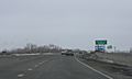
Sign on U.S. Route 41
-
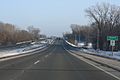
Entering Howard on Wisconsin Highway 29


See also
 In Spanish: Howard (Wisconsin) para niños
