
Seymour, Wisconsin facts for kids
Quick facts for kids
Seymour, Wisconsin
|
|
|---|---|

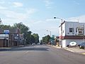
View of Seymour along Highway 55
|
|
| Nickname(s):
Home of the Hamburger
|
|

Location of Seymour in Outagamie County, Wisconsin
|
|
| Country | |
| State | |
| County | Outagamie |
| Founded | 1868 |
| Incorporated | 1879 |
| Government | |
| • Type | Mayor/city council |
| Area | |
| • Total | 2.70 sq mi (6.98 km2) |
| • Land | 2.69 sq mi (6.97 km2) |
| • Water | 0.00 sq mi (0.01 km2) |
| Elevation | 784 ft (239 m) |
| Population
(2020)
|
|
| • Total | 3,546 |
| • Estimate
(2019)
|
3,454 |
| • Density | 1,283.06/sq mi (495.44/km2) |
| Time zone | UTC-6 (Central (CST)) |
| • Summer (DST) | UTC-5 (CDT) |
| ZIP |
54165
|
| Area code(s) | 920 |
| FIPS code | 55-72725 |
| GNIS feature ID | 1573932 |


Seymour is a city in Outagamie County, Wisconsin, in the United States. In 2020, about 3,546 people lived there. It is known as the "Home of the Hamburger"! The city is located near the Town of Seymour and the Town of Osborn.
Contents
History of Seymour
Seymour started as a settlement in 1868. It was named after Governor Horatio Seymour of New York.
Early Settlers Arrive
The first settlers in Seymour were William and John Ausbourne. They traveled from western Outagamie County in 1857. They followed the Wolf River to the Shioc River. Then they moved to where the Black Creek flows into the Shioc.
Since there were no more roads, the Ausbournes settled in the area where Seymour is today. At that time, Native Americans lived there. The Ausbournes built a log house. For two years, it was the only home in Seymour. Their closest neighbors lived in Osborn.
Growth and Development
More settlers came to Seymour over the years. Henry Becker and Herman Husmann arrived in 1859. Willis and Dan Mungers came later that year. They built a house on what is now Main Street. Their daughter Sally lived in a frame house on South Main Street.
Erastus C. Buttles started a farm in the western part of the county. Leaonard and Avery Carter arrived in 1876. Charles Eichler, the first German settler, also came that year.
As more people settled, the population grew. On March 1, 1877, Seymour became a recognized town. The towns of Osborn and Freedom also became recognized towns.
Railroad and City Status
In the early 1880s, the Green Bay and Lake Pepin Railroad was finished. A train station was built in Seymour in 1883. Soon after, Seymour became known as the smallest incorporated city in the nation.
Education Begins
Once houses were built, settlers focused on education. They elected a school superintendent. They also set up a school tax. The first schoolhouse was a simple one-room building. It had no floor and a shake roof.
Local Newspapers
Between 1887 and 1889, George E. Mendell published the first newspaper, The Aurora. It only lasted three years. On July 8, 1886, the Seymour Press first appeared. The Van Vuren family published it for over 80 years. Today, it is still published by the Shellman Publishing Company.
The First Hamburger
"Hamburger" Charlie Nagreen is famous for serving the world's first hamburger. This happened at the Seymour Fair in 1885. He flattened a meatball and put it between slices of bread. This made it easier to eat while walking.
Historical Society and Museum
The Seymour Community Historical Society started on October 11, 1975. A group of local historians helped create it. They collect and save records and objects about Seymour's history.
On July 21, 2012, the new Seymour Community Museum opened. It cost $1.2 million to build. All the money came from private donations.
Geography and Location
Seymour is located at 44°30′30″N 88°19′42″W / 44.50833°N 88.32833°W.
The city covers about 2.67 square miles (6.92 square kilometers) of land. There is no water area within the city limits.
Population and People
| Historical population | |||
|---|---|---|---|
| Census | Pop. | %± | |
| 1880 | 850 | — | |
| 1890 | 733 | −13.8% | |
| 1900 | 1,026 | 40.0% | |
| 1910 | 1,109 | 8.1% | |
| 1920 | 1,280 | 15.4% | |
| 1930 | 1,201 | −6.2% | |
| 1940 | 1,365 | 13.7% | |
| 1950 | 1,760 | 28.9% | |
| 1960 | 2,045 | 16.2% | |
| 1970 | 2,194 | 7.3% | |
| 1980 | 2,530 | 15.3% | |
| 1990 | 2,782 | 10.0% | |
| 2000 | 3,335 | 19.9% | |
| 2010 | 3,451 | 3.5% | |
| 2019 (est.) | 3,454 | 0.1% | |
| U.S. Decennial Census | |||
In 2010, there were 3,451 people living in Seymour. There were 1,458 households. The population density was about 1,292 people per square mile (499 per square kilometer).
Most residents were White (94.3%). Other groups included Native American (2.6%) and African American (0.3%). About 2.0% of the population was Hispanic or Latino.
The average age in the city was 36.1 years. About 26.5% of residents were under 18. About 14.7% were 65 or older.
Transportation in Seymour
Roads and Highways
|
|
WIS 55 is also called Main Street. Northbound, it goes to Angelica. Southbound, it connects to U.S. Highway 41. |
|
|
WIS 54 goes west to Black Creek and New London. Eastward, it leads to Green Bay. |
|
|
Highway C, or Ivory Street, goes north to WIS 54/WIS 55. Southbound, Highway C leads to Highway E. |
|
|
Highway G, or Pearl Street, starts at WIS 47. It ends at Highway Y. |
Nearby Airports
Major airports close to Seymour include:
- Austin Straubel International Airport in Ashwaubonon.
- Appleton International Airport in Greenville.
Education in Seymour

Seymour has one middle school, one high school, and one elementary school. They are all part of the Seymour Community School District. This district started in 1963. It covers about 175 square miles (450 square kilometers).
The district includes five schools:
- Rock Ledge Primary Center
- Rock Ledge Intermediate Center
- Seymour Middle School
- Seymour High School
- Black Creek Elementary/Middle School
The schools have great facilities. There is a 27,000 square foot (2,500 square meter) athletic center. It can seat over 1,800 people. There is also an aquatic center with an eight-lane swimming pool and a diving area.
Media and Entertainment
Newspapers
Newspapers that serve Seymour include:
- The Advertiser Community News~Times Press (based in Seymour)
- The Green Bay Press-Gazette (based in Green Bay)
- The Post~Crescent (based in Appleton)
Radio Stations
WFZZ (104.3 The Fuse) is the only radio station located in Seymour.
Television Shows Featuring Seymour
- On June 30, 2011, Only in America from the History Channel filmed a part of an episode in Seymour. They visited the "Home of the Hamburger".
- In 2012, the British children's travel comedy show All Over The Place featured Seymour. The CBBC presenters visited the "Home of the Hamburger" fest.
Fun Attractions
Hamburger Hall of Fame
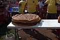
Seymour's Hamburger Hall of Fame celebrates the history of hamburgers. There is also an annual one-day Burger Fest. In 1989, the world's largest hamburger was served at the festival. It weighed 5,520 pounds (2,504 kg)! Since then, the big burger at the festival usually weighs around 190 pounds (86 kg).
The Burger Fest happens in the first week of August. It includes:
- A 5K run called the Bun Run.
- The world's longest hamburger parade down Main Street.
- A hamburger-eating contest.
- A Balloon Rally.
- A fun ketchup slide!
The festival has a different theme each year. You can find a statue of Charlie Nagreen on Depot Street.
-

Giant burger 2018
-
Giant burger 2018
-

Ketchup slide 2018


Outagamie County Fairgrounds

Seymour hosts the yearly Outagamie County Fair. It features 4-H crafts, farm animals, carnival rides, games, and concerts every night.
Seymour Community Museum
The Seymour Community Museum collects and saves historical items. These items tell the story of Seymour and the surrounding area. The museum is located on Depot Street in downtown Seymour.
Outagamie Speedway
Outagamie Speedway is at the Outagamie County Fairgrounds. It is a 1/3-mile (0.54 km) clay racetrack. It has modern grandstands and facilities. Races are held every Friday night during the summer. Different types of cars race here. At the end of the season, a champion is crowned for each division.
Newton-Blackmour State Trail
The Newton Blackmour State Trail is 24 miles (39 km) long. It stretches from Seymour to New London. In winter, people use the trail for snowmobiling, snowshoeing, and cross-country skiing. In summer, it's great for hiking, biking, and horseback riding. The trail's name comes from the four towns it connects.
Famous People from Seymour
- Marvin E. Babbitt, a Wisconsin politician
- Sandy Cohen, a professional basketball player
- Ty Majeski, a racing driver
- Carlisle Runge, a lawyer and diplomat
- Calahan Skogman, an actor and former athlete
Images for kids
-
Northbound on Highway 55
-
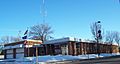
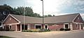
City hall
-
Seymour Community Museum
-
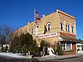
Muehl Public Library


See also
 In Spanish: Seymour (Wisconsin) para niños
