Waupaca County, Wisconsin facts for kids
Quick facts for kids
Waupaca County
|
|
|---|---|

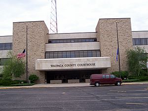
Waupaca County Courthouse
|
|

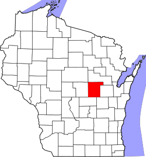
Location within the U.S. state of Wisconsin
|
|
 Wisconsin's location within the U.S. |
|
| Country | |
| State | |
| Founded | 1853 |
| Named for | Chief Waupaca |
| Seat | Waupaca |
| Largest city | New London |
| Area | |
| • Total | 765 sq mi (1,980 km2) |
| • Land | 748 sq mi (1,940 km2) |
| • Water | 17 sq mi (40 km2) 2.3%% |
| Population
(2020)
|
|
| • Total | 51,812 |
| • Estimate
(2023)
|
51,388 |
| • Density | 69.3/sq mi (26.8/km2) |
| Time zone | UTC−6 (Central) |
| • Summer (DST) | UTC−5 (CDT) |
| ZIP Codes |
54981
|
| Congressional district | 8th |
Waupaca County is a county in the state of Wisconsin. In 2020, about 51,812 people lived there. The main city and county seat is Waupaca.
The county was created in 1851 and officially started in 1853. Its name comes from the Waupaca River. This name is from the Menominee language and can mean 'white sand bottom', 'pale water', or 'tomorrow river'.
Contents
Exploring Waupaca County's Past
Waupaca County has a long and interesting history. Long ago, Native American people built special mounds in the ground. These mounds showed their beliefs and important ideas.
Ancient Earth Mounds
One early explorer counted 72 of these mounds in the area. Many were effigy mounds, shaped like animals or people. For example, some looked like humans, turtles, or catfish. There were 52 mounds built around what is now Taylor Lake.
Most of these old mounds are now gone because of farming. But you can still see one mound shaped like a catfish. It is in a private yard near Taylor Lake. A local women's club placed a special plaque there to mark the spot.
New Settlers Arrive
The Menominee people were the original owners of this land. In 1852, they signed a treaty to give their land to the United States. After this, many new settlers came to the area. They moved from places like New England, New York, and Ohio.
These new settlers mostly used the land for farming. They also quickly built sawmills along the rivers. This helped them cut down trees for wood.
Railroads and Growth
In the 1870s, railroads came to Waupaca County. The Wisconsin Central Railroad arrived in 1872. The Green Bay and Minnesota Railroad came in 1873. These railroads made it easier to transport lumber and other goods. This helped the county's economy grow. People who worked in the lumber business made good money. They built many nice homes in the bigger cities.
Geography and Nature
Waupaca County covers about 765 square miles. Most of this area is land, about 748 square miles. The rest, about 17 square miles, is water.
Waupaca's Waterways
The county is famous for its 22 lakes, known as the Waupaca Chain O' Lakes. Most of these lakes are fed by natural springs. They are all connected by the Crystal River. Waupaca County also has Partridge Lake on the Wolf River and the Waupaca River.
Major Roads and Transportation
Many important roads run through Waupaca County. These roads help people travel and transport goods.
Railroads Serving the County
Two railroad companies operate in Waupaca County:
- Canadian National
- Watco
Local Airports
The county has two airports for small planes:
- KCLI - Clintonville Municipal Airport
- KPCZ - Waupaca Municipal Airport
Neighboring Counties
Waupaca County shares borders with several other counties:
- Shawano County (north)
- Outagamie County (east)
- Winnebago County (southeast)
- Waushara County (southwest)
- Portage County (west)
- Marathon County (northwest)
People of Waupaca County
The county's population has changed over many years. Here's how it has grown:
| Historical population | |||
|---|---|---|---|
| Census | Pop. | %± | |
| 1860 | 8,851 | — | |
| 1870 | 15,539 | 75.6% | |
| 1880 | 20,955 | 34.9% | |
| 1890 | 26,794 | 27.9% | |
| 1900 | 31,615 | 18.0% | |
| 1910 | 32,782 | 3.7% | |
| 1920 | 34,200 | 4.3% | |
| 1930 | 33,513 | −2.0% | |
| 1940 | 34,614 | 3.3% | |
| 1950 | 35,056 | 1.3% | |
| 1960 | 35,340 | 0.8% | |
| 1970 | 37,780 | 6.9% | |
| 1980 | 42,831 | 13.4% | |
| 1990 | 46,104 | 7.6% | |
| 2000 | 51,731 | 12.2% | |
| 2010 | 52,410 | 1.3% | |
| 2020 | 51,812 | −1.1% | |
| U.S. Decennial Census 1790–1960 1900–1990 1990–2000 2010–2020 |
|||
Population in 2020
In 2020, the county had 51,812 people. There were about 69 people living in each square mile. There were also 25,457 homes.
Most people in the county, about 93.2%, were White. Other groups included Native American (0.6%), Asian (0.5%), and Black or African American (0.4%). About 1.6% of people were from other races. Also, 3.7% of people were from two or more races. About 3.6% of the population was Hispanic or Latino.
Cities, Towns, and Villages
Waupaca County has many different places where people live.
Cities in Waupaca County
- Clintonville
- Manawa
- Marion (partly in Shawano County)
- New London (partly in Outagamie County)
- Waupaca (the county seat)
- Weyauwega
Villages in Waupaca County
Towns in Waupaca County
Census-Designated Places
These are areas that the Census Bureau defines for counting people.
Unincorporated Communities
These are smaller communities that are not officially cities or villages.
Historic Ghost Towns
Some places that once existed in Waupaca County are now "ghost towns" or old neighborhoods.
- Granite City
- Granite Quarry
- Hatton
- Little Wolf
- Marble
- Nowell
- Petersville
See also
 In Spanish: Condado de Waupaca para niños
 | George Robert Carruthers |
 | Patricia Bath |
 | Jan Ernst Matzeliger |
 | Alexander Miles |


