
Portage County, Wisconsin facts for kids
Quick facts for kids
Portage County
|
||
|---|---|---|

Portage County Courthouse in Stevens Point
|
||
|
||

Location within the U.S. state of Wisconsin
|
||
 Wisconsin's location within the U.S. |
||
| Country | ||
| State | ||
| Founded | 1844 | |
| Named for | the portage between the Fox and Wisconsin Rivers | |
| Seat | Stevens Point | |
| Largest city | Stevens Point | |
| Area | ||
| • Total | 823 sq mi (2,130 km2) | |
| • Land | 801 sq mi (2,070 km2) | |
| • Water | 22 sq mi (60 km2) 2.7%% | |
| Population
(2020)
|
||
| • Total | 70,377 | |
| • Estimate
(2023)
|
71,024 |
|
| • Density | 87.9/sq mi (33.9/km2) | |
| Time zone | UTC−6 (Central) | |
| • Summer (DST) | UTC−5 (CDT) | |
| Congressional district | 3rd | |

Portage County is a county located in the state of Wisconsin in the United States. It's a place where many people live and work. As of the 2020 census, about 70,377 people called Portage County home. The main city and where the county government is located is Stevens Point.
Portage County is part of a larger area that includes Stevens Point. This area is important for jobs and businesses. It also connects to other nearby cities like Wausau and Wisconsin Rapids.
Contents
History of Portage County
Portage County was officially created in 1836, when Wisconsin was still a territory. It started to organize its own government in 1844. The county gets its name from a special place called a "portage." A portage is a path where people used to carry their boats and goods between two rivers. In this case, it was between the Fox River and the Wisconsin River.
Even though the county is named after this portage, the actual path and the city of Portage are no longer inside Portage County. The county's borders changed over time.
Geography and Nature
Portage County covers a total area of about 823 square miles. Most of this area, about 801 square miles, is land. The rest, about 22 square miles, is water. This means about 2.7% of the county is covered by water, like rivers and lakes.
How to Get Around Portage County
There are many important roads and ways to travel through Portage County.
Major Roads and Highways
 Interstate 39
 U.S. Highway 10
 U.S. Highway 51
 Highway 13 (Wisconsin)
 Highway 22 (Wisconsin)
 Highway 34 (Wisconsin)
 Highway 49 (Wisconsin)
 Highway 54 (Wisconsin)
 Highway 66 (Wisconsin)
 Highway 73 (Wisconsin)
 Highway 161 (Wisconsin)
Trains, Buses, and Air Travel
- Trains: The Canadian National railway line runs through the county.
- Buses: Stevens Point Transit provides bus services for people to travel within the Stevens Point area.
- Airport: The Stevens Point Municipal Airport (KSTE) is available for air travel.
Neighboring Counties
Portage County shares its borders with several other counties:
- Marathon County to the north
- Shawano County to the northeast
- Waupaca County to the east
- Waushara County to the southeast
- Adams County to the southwest
- Wood County to the west
Special Natural Areas
Portage County is home to several wildlife refuges and natural areas. These places help protect different plants and animals.
- Buena Vista Marsh
- Dewey Marsh
- Mead Wildlife Area
- Paul J. Olson Wildlife Area
People of Portage County
The number of people living in Portage County has changed over many years.
| Historical population | |||
|---|---|---|---|
| Census | Pop. | %± | |
| 1840 | 1,623 | — | |
| 1850 | 1,250 | −23.0% | |
| 1860 | 7,507 | 500.6% | |
| 1870 | 10,634 | 41.7% | |
| 1880 | 17,731 | 66.7% | |
| 1890 | 24,798 | 39.9% | |
| 1900 | 29,483 | 18.9% | |
| 1910 | 30,945 | 5.0% | |
| 1920 | 33,649 | 8.7% | |
| 1930 | 33,827 | 0.5% | |
| 1940 | 35,800 | 5.8% | |
| 1950 | 34,858 | −2.6% | |
| 1960 | 36,964 | 6.0% | |
| 1970 | 47,541 | 28.6% | |
| 1980 | 57,420 | 20.8% | |
| 1990 | 61,405 | 6.9% | |
| 2000 | 67,182 | 9.4% | |
| 2010 | 70,019 | 4.2% | |
| 2020 | 70,377 | 0.5% | |
| U.S. Decennial Census 1790–1960 1900–1990 1990–2000 2010 2020 |
|||
In 2020, the population was 70,377 people. This means there were about 87.9 people living in each square mile. There were also many homes, with about 31,148 housing units. Most people in the county are White (89.5%). Other groups include Asian (3.2%), Black or African American (1.3%), and Native American (0.4%). About 3.7% of the population is of Hispanic or Latino background.

Cities, Towns, and Villages
Portage County has one main city and many smaller communities.
City
- Stevens Point (This is the county seat, where the main government offices are.)
Villages
Towns
Other Communities
Census-designated places
These are areas that are like towns but are only recognized for census (population counting) purposes.
Unincorporated communities
These are smaller communities that don't have their own local government like a city or village.
Ghost town/neighborhood
- Lake Emily (This is a place that used to be a community but is no longer populated.)
Images for kids
-
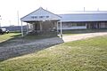
Fairgrounds
-
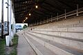
Grandstands at the county fairgrounds
-
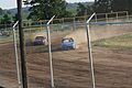
4 cylinder stock cars racing at the county fairgrounds


See also
 In Spanish: Condado de Portage (Wisconsin) para niños
