Garfield, Portage County, Wisconsin facts for kids
Quick facts for kids
Garfield, Wisconsin
|
|
|---|---|
| Country | |
| State | |
| County | Portage |
| Elevation | 349 m (1,145 ft) |
| Time zone | UTC-6 (Central (CST)) |
| • Summer (DST) | UTC-5 (CDT) |
| Area code(s) | 715 and 534 |
| GNIS feature ID | 1577608 |
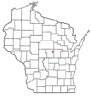
Garfield is a small, unincorporated community located in Portage County, Wisconsin, in the United States. An "unincorporated community" means it's a group of homes and businesses that isn't officially a city or town with its own local government. Instead, it's part of a larger county area.
Exploring Garfield's Location
Garfield is found in the central part of Wisconsin. It sits about halfway between two other communities, Rosholt and Nelsonville. You can find it along Portage County Road A.
Where is Garfield Exactly?
This community is located about 2.5 miles (about 4 kilometers) west of another small place called Peru. It's currently located within the Town of New Hope. You'll find Garfield right at the intersection of Portage County Road A (heading south) and Portage County Road Z (heading east).
Local Waterways and Nature
Two important waterways near Garfield are Poncho Creek and the Tomorrow River. These are located southwest of the community. These areas are becoming part of the Richard A. Hemp Fishery Area, which is a special place for fishing and protecting nature.
 | Toni Morrison |
 | Barack Obama |
 | Martin Luther King Jr. |
 | Ralph Bunche |


