Oconto County, Wisconsin facts for kids
Quick facts for kids
Oconto County
|
|
|---|---|
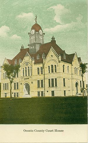
The Oconto County Courthouse, circa 1910
|
|
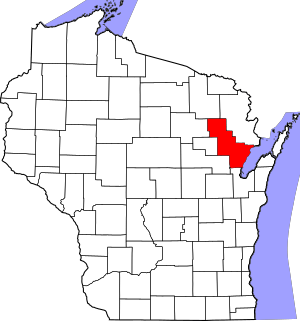
Location within the U.S. state of Wisconsin
|
|
 Wisconsin's location within the U.S. |
|
| Country | |
| State | |
| Founded | 1854 |
| Named for | Oconto River |
| Seat | Oconto |
| Largest city | Oconto |
| Area | |
| • Total | 1,149 sq mi (2,980 km2) |
| • Land | 998 sq mi (2,580 km2) |
| • Water | 151 sq mi (390 km2) 13%% |
| Population
(2020)
|
|
| • Total | 38,965 |
| • Estimate
(2023)
|
39,775 |
| • Density | 39.1/sq mi (15.1/km2) |
| Time zone | UTC−6 (Central) |
| • Summer (DST) | UTC−5 (CDT) |
| Congressional district | 8th |
Oconto County is a county located in the state of Wisconsin in the United States. About 38,965 people lived here in 2020. The main city and county seat is Oconto. The county was officially started in 1851.
Oconto County is part of the larger Green Bay area. This means it is connected to the economy and community of Green Bay.
Contents
A Look Back in Time
People first visited Oconto County a very long time ago. French explorers came here in the 1600s. One of the first religious leaders, Father Claude-Jean Allouez, held the first Christian service in Oconto.
An early explorer named Joseph Tourtilott explored the Oconto River area. Oconto County was officially created in 1851. It was fully organized and ready to go in 1854.
Where is Oconto County?
According to the U.S. Census Bureau, Oconto County covers a total area of 1,149 square miles. Most of this area, 998 square miles, is land. The rest, 151 square miles, is water. This means about 13% of the county is covered by water.
Neighboring Areas
Oconto County shares its borders with several other counties. These are its neighbors:
- Marinette County to the northeast
- Door County to the southeast, across Green Bay
- Brown County to the south
- Shawano County to the southwest
- Menominee County to the west
- Langlade County to the west
- Forest County to the northwest
Roads, Rails, and Air
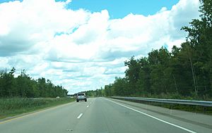
Many important roads pass through Oconto County. These highways help people travel and transport goods.
 U.S. Highway 41
 U.S. Highway 141
 Highway 22 (Wisconsin)
 Highway 32 (Wisconsin)
 Highway 64 (Wisconsin)
Trains also run through the county. Two main railroad companies operate here:
- Canadian National
- Escanaba and Lake Superior Railroad
For air travel, the J. Douglas Bake Memorial Airport serves Oconto County. It helps connect the area to other places by air.
Nature's Protection
Part of the Nicolet National Forest is located in Oconto County. This is a protected area of nature. It helps keep the forests and wildlife safe.
Who Lives Here?
| Historical population | |||
|---|---|---|---|
| Census | Pop. | %± | |
| 1860 | 3,592 | — | |
| 1870 | 9,321 | 159.5% | |
| 1880 | 9,848 | 5.7% | |
| 1890 | 15,009 | 52.4% | |
| 1900 | 20,874 | 39.1% | |
| 1910 | 25,657 | 22.9% | |
| 1920 | 27,104 | 5.6% | |
| 1930 | 26,386 | −2.6% | |
| 1940 | 27,075 | 2.6% | |
| 1950 | 26,238 | −3.1% | |
| 1960 | 25,110 | −4.3% | |
| 1970 | 25,553 | 1.8% | |
| 1980 | 28,947 | 13.3% | |
| 1990 | 30,226 | 4.4% | |
| 2000 | 35,634 | 17.9% | |
| 2010 | 37,660 | 5.7% | |
| 2020 | 38,965 | 3.5% | |
| U.S. Decennial Census 1790–1960 1900–1990 1990–2000 2010 2020 |
|||
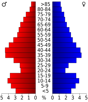
In 2020, the population of Oconto County was 38,965 people. This means there were about 39 people living in each square mile. Most people living in the county are White. There are also people from Native American, Asian, and Black backgrounds. Some people identify with two or more races. A small part of the population is of Hispanic or Latino origin.
Towns and Cities
Oconto County has several different types of communities. These include cities, villages, and towns.
Cities
- Gillett
- Oconto (This is the county seat, the main city for county government)
- Oconto Falls
Villages
Towns
Special Communities
Some places are called "census-designated places." These are areas that look like towns but are not officially incorporated. There are also small, unincorporated communities.
- Unincorporated communities:
- Native American community:
- Ghost towns/neighborhoods:
- Leighton
- Pine Stump
See also
 In Spanish: Condado de Oconto para niños
 | Claudette Colvin |
 | Myrlie Evers-Williams |
 | Alberta Odell Jones |


